For several weeks now I have attempted to get my average speed on a paddleboard past 4.9 mph. today I finally broke that barrier and hit an average of 5.0. Oddly enough I did it at elevation at around 8500 feet on Electric Lake, In the mountains high above my house. This average is based on a 30 minute out and back time trial effort.
Beginning of the day. Board with PFD attached on the very front, a dry bag with supplies (mostly water or Cytomax) & an extra paddle for kayak style use (in case the winds get out of control).
Paddling out into the wild blue yonder.
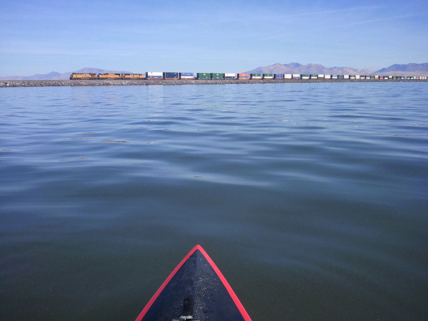
Freight train on the causeway.
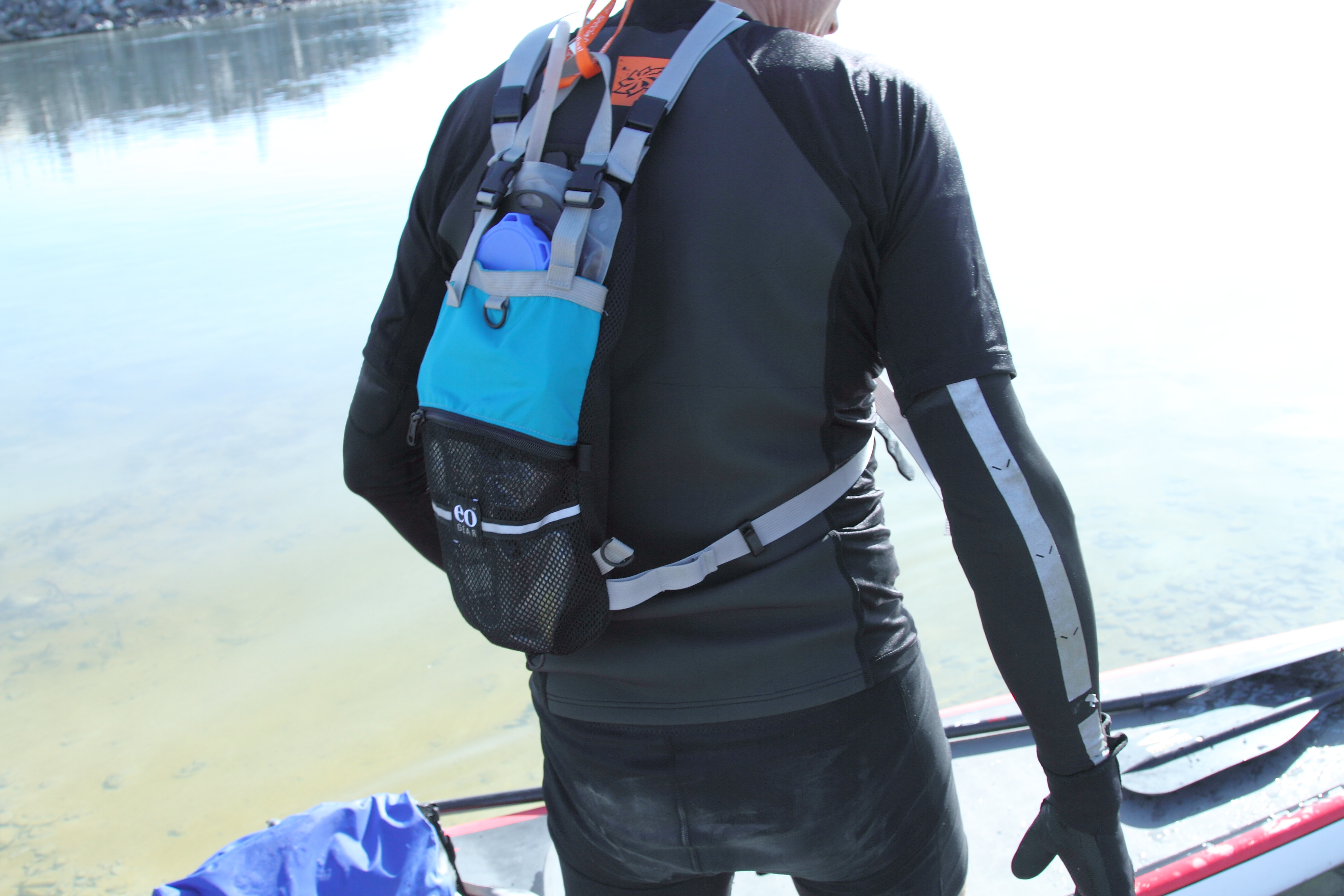
Close up of eoGEAR prototype hydration pack.
Shallow, but clear waters near Promontory Point. This was my favorite part of the journey. It was so shallow, despite being some 200+ yds off shore, that I had to step off the board and drag it out into deeper waters.
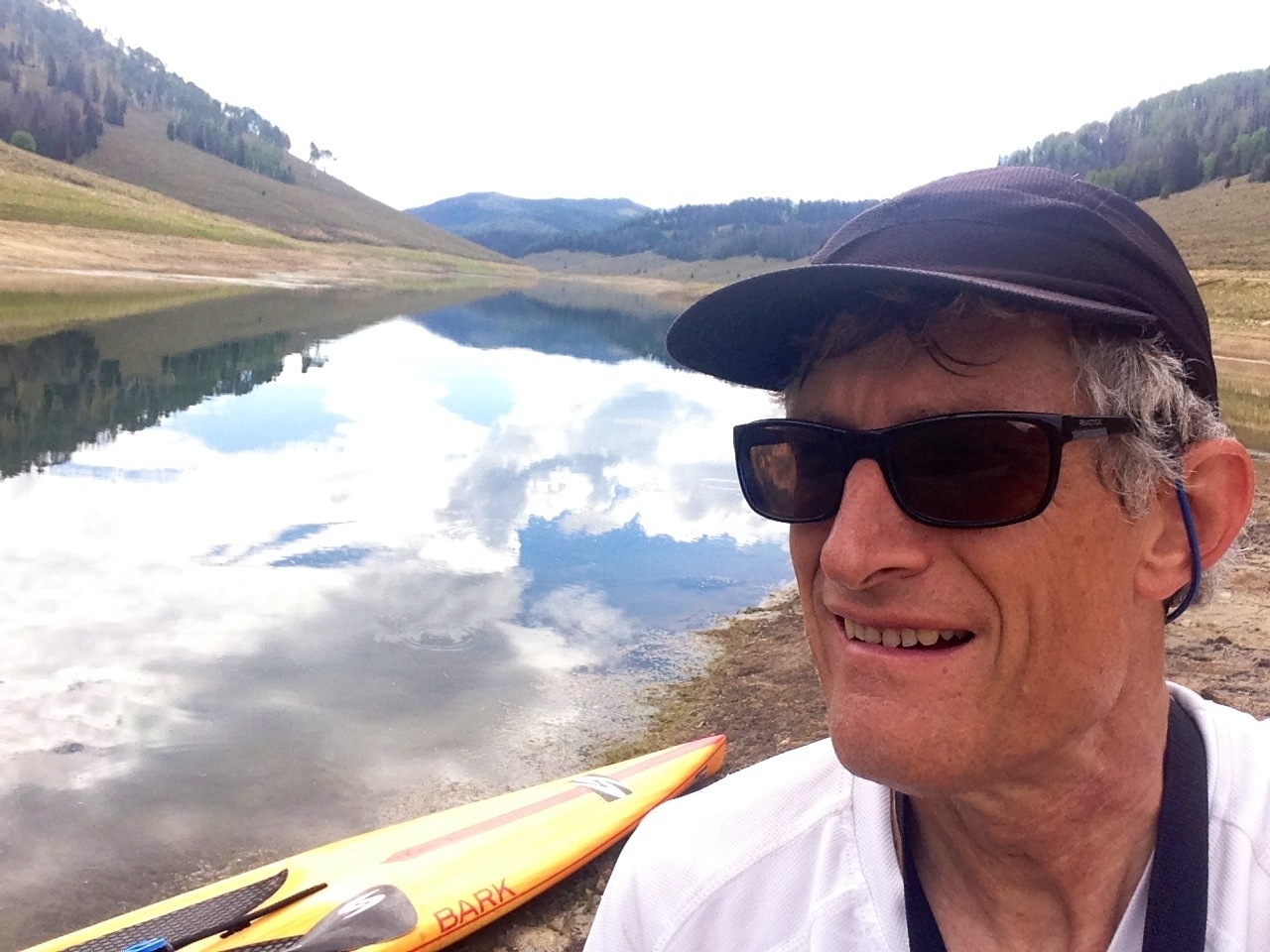
Self portrait during a lunch break.
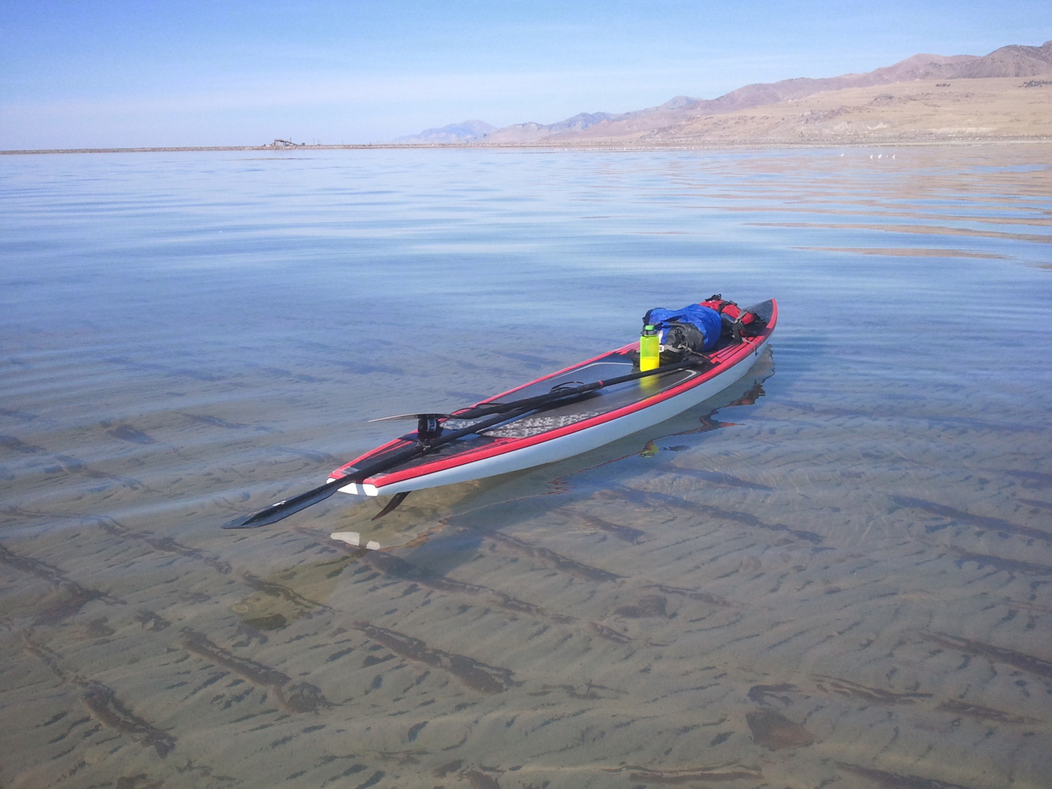
Board near Promontory Point
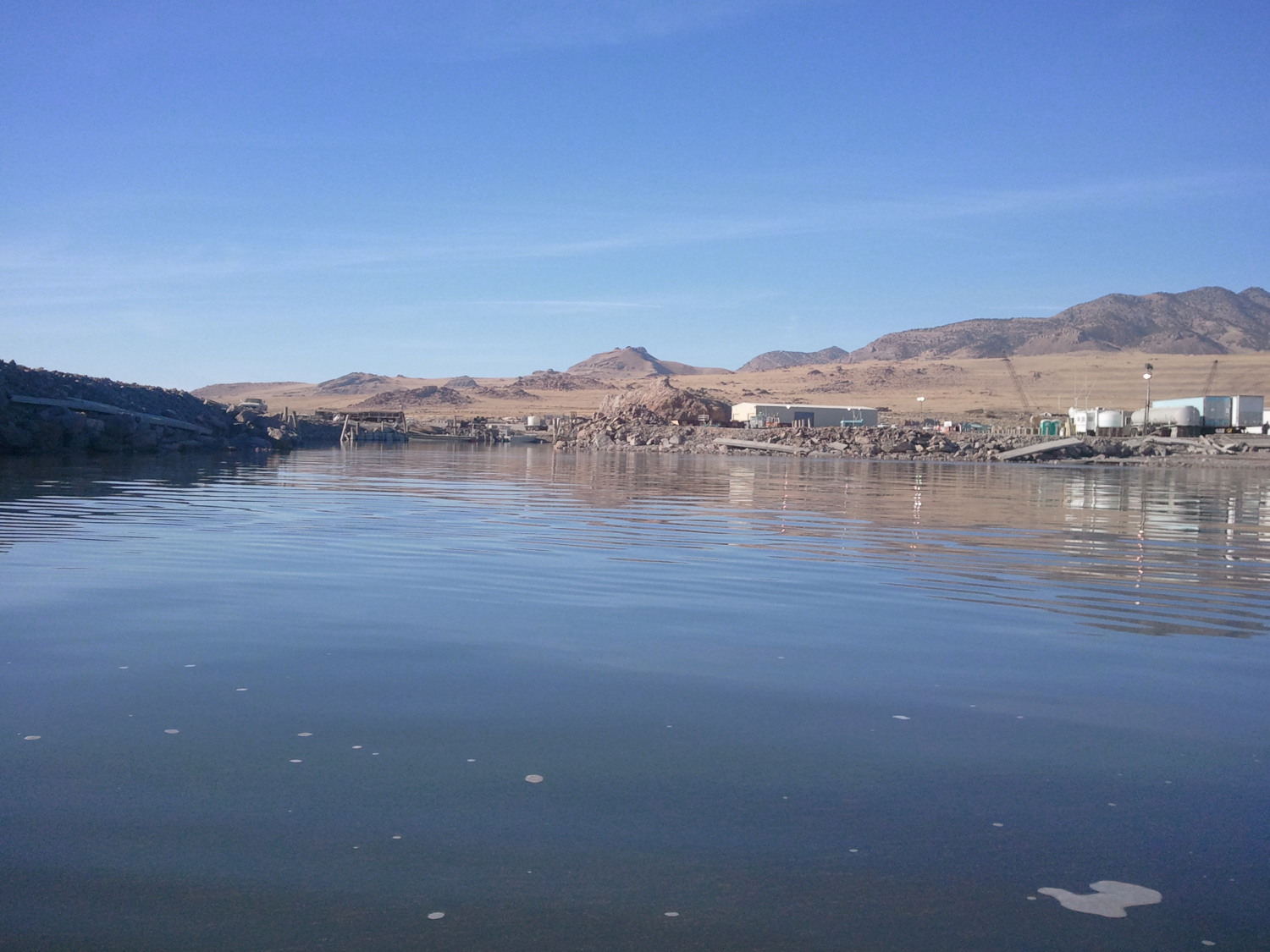
Shrimpers Harbor near the point. Nice looking place, huh?
Approaching the finish. The reflections indicate what a nice, windless day it was.
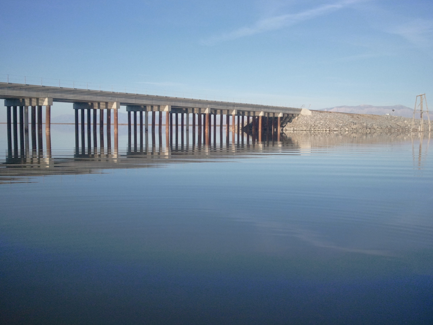
Closer in shot of the Bear River Bridge, which I passed under to complete this tour.
Sunset after finally attaching the board to the car, ready to head home.
Salt soaked gear. I wore a light neoprene outfit because of the cool (64F) water temps this time of year.
Here is GPS upload to Strava.com.
On October 9th, 2012 I did a crossing of the width of the Great Salt Lake on a stand-up paddle board. It was my understanding that this was the first-ever crossing of the lake via SUP, but I have been told since then, that other groups have done it previously (although I have not seen any GPS downloads or blog reports confirming it). Perhaps this was the first ever solo, unsupported crossing. I did this 28 mile starting just after 10 a.m. The ambient temps during the day ranged from about 50F to 68F with a water temperature of 62F. I specifically picked this day as the forecast had a wind of only 6 MPH in the morning decreasing to 1 or 2 MPH by the afternoon — perfect conditions for a safe trip on such a body of water. My moving time was 6:54 for a total travel time of about 7:41. I traveled from the west near the railroad causeway, which crosses this lake in a east/west direction. This was for safety, so that if there were any issues, I could paddle towards it and latch on. This time of year, I went about as far east as I could go before running into the dreaded biotherms or before hitting very shallow waters and unable to paddle any further. In fact, the last three of four miles, I had to stand forward on my board while paddling as my rear fin was dragging on the bottom of the lake!
Here’s a link to an online map with my planned route. My actual mileage was bout 7/10s of a mile longer, probably due to my uneven path while paddling. This is a Strava upload of my trip.
Next up, a south or north crossing? That would be a 75-mile adventure. Hmmm, that would be one long day and part of a night.
Many thanks to Dave Shearer, the harbor master for his advice on access and conditions and to my daughter Rosemary for making rather long shuttle required for this effort.
Gear notes:
> My board was a 14’0″ x 28″ carbon fiber Admundson TR-X with a Surftech carbon fiber SUP paddle (their so-called small-size blade). I have since then replaced this board with a better “flat water” unit, that has less rocker. My back-up paddle was a “clunky kayak” Cairsle.
> I was testing a new SUP-specific hydration backpack which I’m designing for release next spring (eoGEAR Inc.). In it I used a 2-liter bladder and later switched out to a 1.5-liter bladder after I consumed the first one. Both were filled with Cytomax. In my dry bag I also had a liter of Hammer Perpeteum and two liters of water. I had way more fluids that I needed.
> The other product I was testing was a tie-down system for gear. They are designed with quick-release buckles which secured a Seattle Sports wide mouth dry bag and also my PFD.
> I was also testing a rough prototype of a device to hold a watch style GPS to the board for use in navigating. Half way through the paddle, I switched, mounting it my chest pouch.
Postscript: Today (30 Oct 2012) I did a “radio” interview on SUP Radio, which is now available as a Podcast.
I carried a PFD as precaution as because most states require a PFD and a whistle when traveling on their lakes or reservoirs.
In an effort to get a more balanced (upper) body, I purchased a used stand up paddleboard in August (SUP, also called stand up paddle surfing). After a half a dozen training trips at some local reservoirs and lakes, I decided to paddle out to a small landmark in Utah Lake, called Bird Island on September the 30th (2011). I had not been there before. The forecast was for a pleasant 87F. It is 2.2 miles from the Lincoln Beach Boat Ramp (no fee like the State Park near Provo). I had printed the coordinates as found on a local website, but that sheet of paper failed to make it with into my car. I did have my GPS however. I made a GPS waypoint at my car and then I proceeded out into the lake hoping I could see the island. After 10 minutes of paddling and not being able to see any evidence of the island, I paddled over to a nearby fisherman and asked which direction the island was. He pointed in a NE direction towards Provo and said “be careful.” Using the distant mountains as a guide I proceeded in that direction, but still no site of the island. Eventually I decided I better just stop and I use the browser on my cell phone to find the coordinates. As it turns out, the “island” was in the direction of Lehi, almost due north, and not northeast as I was traveling. It indicated that the island as 1.1 miles away. I was half way there.
I used the low point near Lehi (or Point of the Mountain) as my guide and continued on, arriving at this tiny landmark, surrounded by 3 or 4 fishing boats. I was a bit surprised to find there was no dry land on this so-called “island.” After taking a few photos, I quietly paddled over to one of the boats. One of the fisherman, clothed in a classic wife-beater shirt and smoking a cigarette, remarked “you came clear out here on that?” I asked him if this island was always submerged. Apparently it is typically not always under water, but because of the banner snowfall the previous winter, it was submerged this season. Afterward I reversed my visual coordinates and paddled back to the prominent tree, visible near the boat ramp, some 2 miles away.
Stats
GPS Coordinates (UTM, 12T zone):
Lincoln Beach Boat Ramp – 0431557 E, 4443892 N
Bird ”Island” — 0431781 E, 4447528 N
Gear Tested
• 10′ 6″ “much too short” Wave Storm board with a custom Velcro PFD tie down strap system which I made that morning (I’m in the hunt for a deal on a 12’6″ board — if you have one, let me know).
• On my training trips I wore a running waist pack with a water bottle, but found it very awkward to drink while standing and paddling at the same time. I cobbled together a hydration pack system using components from my photo belt system which I sell (Kinesis Photo Gear, my day job), and a new compact 50 oz. Camelbak bladder, which I pulled from my DistanceBiker online store inventory. I tucked the hose underneath my left armpit and connected it to the harness of my pack. This enabling me to drink and paddle at the same time, w/o having to pause and fumble with a waist pack. This week’s project: make a prototype SUP minimalist hydration pack.
• I also noticed that the smooth shaft of my carbon fiber Surftech San-O paddle became rather slippery due to my sweat (on the lower hand position). Upon arriving home, I added several wraps of photographers gaffer tape around the center of the shaft to provide more grip. This paddle, while advertised as a 91-inch paddle, came uncut at 88-1/4″ (34.75cm). I cut it down to 86″, which is 10 inches more than my height. The weight of this wispy paddle was 552 grams, after cutting it down and before adding tape to it. The shape of the shaft is round and it has a traditional-looking with a 8-inch wide blade. Overall it is an OK paddle, but I believe that Werner makes a better mousetrap (but their advertised one piece paddles are too short for me, so I went with Surftech instead).