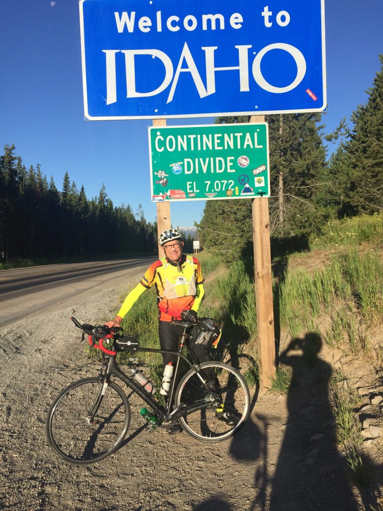
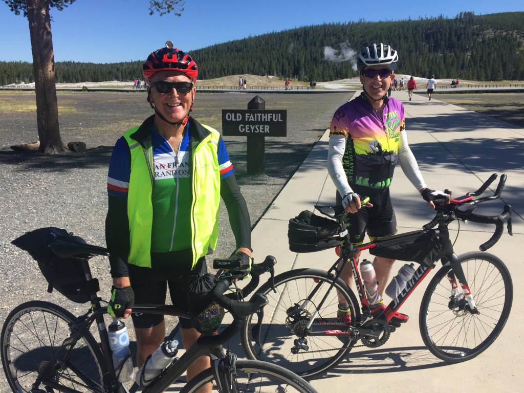
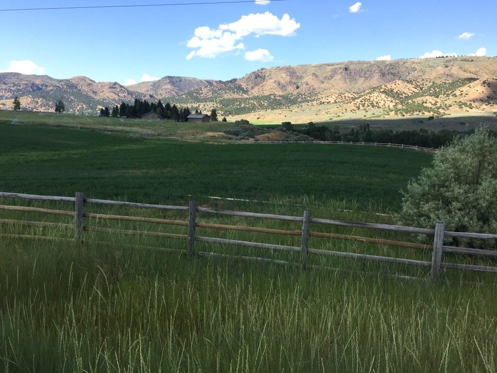
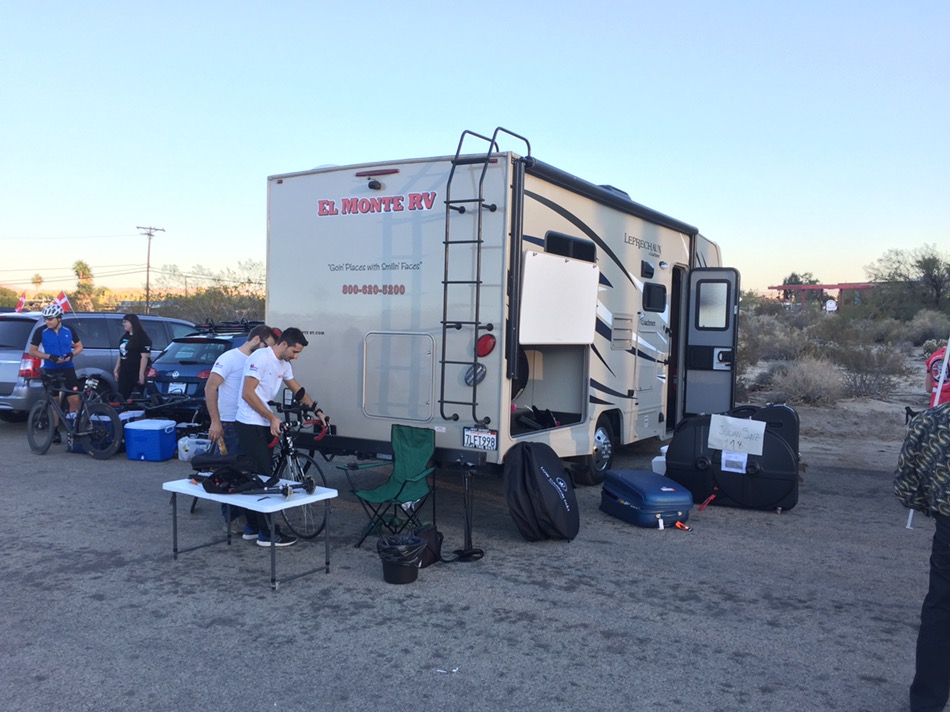
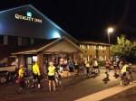
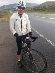
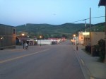
In July of 2017 (13–15th) I sponsored a 1000K brevet (~ 625 miles) that went through Yellowstone and Grand Teton National Parks…plus Starr Valley Wyoming. This route started in Ashton, Idaho, which is just west of Yellowstone National Park.
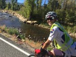
Day one: Our route heading north though the town of West Yellowstone and then into the park’s west entrance. It then made a big loop through the park. We left at 4:00 a.m. and four of us stayed mostly together, with the others waiting for me on the climbs. We arrived back to Ashton for our first overnight just after dusk, at about 9:30 p.m. We then learned that one of the other two rides was bumped or hit by the mirror of an SUV. He was then transported to the hospital by the spouse of another rider for evaluation. He was not knocked off his bike, but it caused a massive bruise. Needless to say, it put him out of the “race.” Totals for the day: 235 miles with 9,570 feet of climbing.
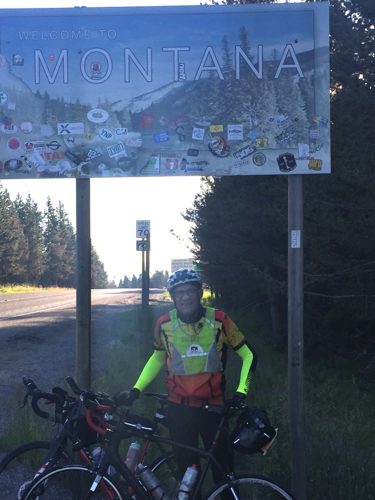
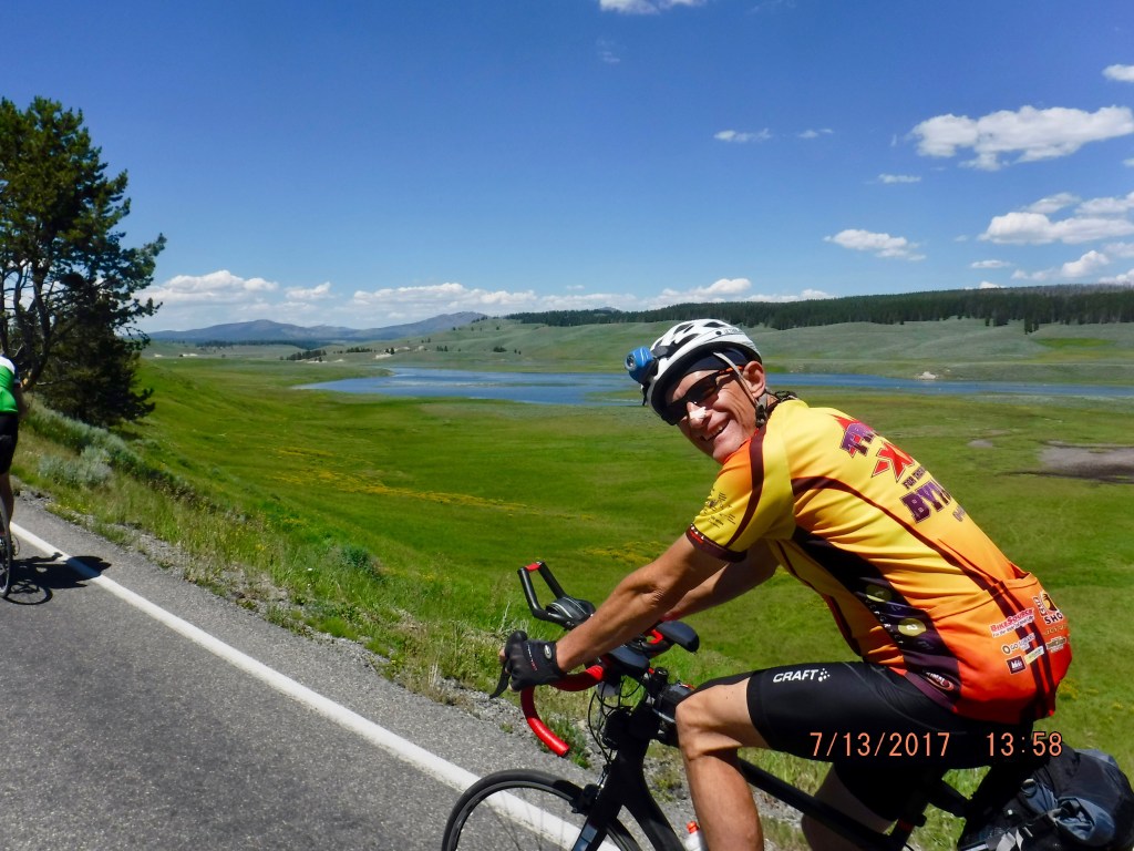
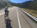
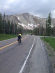
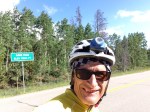
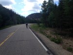
Day two: We decided to leave at 4:00 a.m. on the second day. Our route took us through rural Driggs Idaho, with the west side of the Teton mountain range in the background. That was one of coolest sunrises I have ever seen. From there we climbed up and over Teton Pass. The grades were not impossible, at around 9 or 10%, but I was really hurting. I ended up walking most of the upper part of this pass. I just had nothing in the tank! I attempted to text my friends to not wait for me, as this took a while, but I couldn’t get cellular coverage. On the descent, I set a new P.R., hitting 55 MPH on a bicycle. The ascent, on the other hand, was also a new record for me…my first time walking a pass on a bicycle ride! Two personal records in one day. We made our way along the eastern edge of the Teton range and up to the southern boundaries of Yellowstone before turning around and making our way back to Jackson Hole. Paul Foley literally pulled me for the last half that day, while we sent the other two on ahead. We arrived into the motel at about 12:45 a.m. Totals for the day: 201 miles with 9,397 feet of climbing.
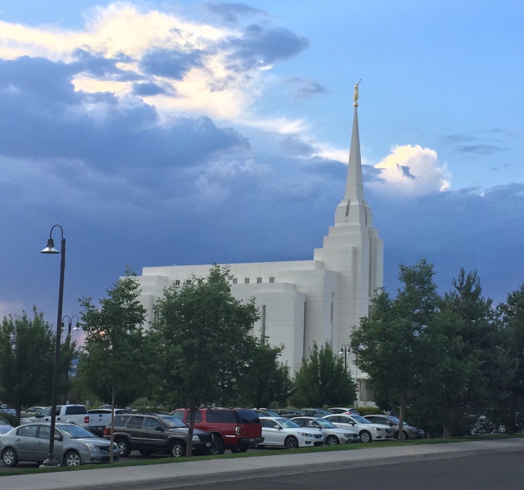
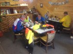
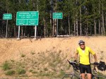
Day three: Since this was a shorter day, we left at about 6:00 a.m., after making a fast food pit stop. The route goes south into fabulous Starr Valley (part of the LoToJa race route) and then we headed northwest into Rexburg, home of BYU-Idaho, before finishing up in Ashton again. Near Rexburg, there were many miles of flat or rollers. We organized into a pace line and Paul pulled our little group of four for hours on end! Many, many thanks to him for his perseverance. When we got closer to our final destination we could see a thunderstorm ahead, but we were spared any rain. However the power was out everywhere in this town upon our arrival, due to the storm. We got in at 10:27 p.m., relieved that our adventure was finally over without incident and any mechanical problems. For most of us, that was our longest ride or brevet of the summer. Totals for the day: 188 miles with “only” 5,804 feet of climbing.
The following day, I stopped in to visit my son, who is a student at BYU-I in Rexburg, some 35 miles to the south. We did a walking tour of campus. I was so fatigued that I could not even walk up a complete flight of stairs without stopping! Something was wrong. The next month I DNFed on a rather easy 600K after 400km. I just had no energy to ride. Shortly thereafter, I had some blood tests which showed I had anemia or iron-poor blood. My hemoglobin and ferritin levels were on the low side of normal. This explained my very poor performance during the later part of this summer. As it turns out, my anemia was caused by a bleeding ulcer which was caused by a regimen of Aspirin, which my cardiologist put me on.
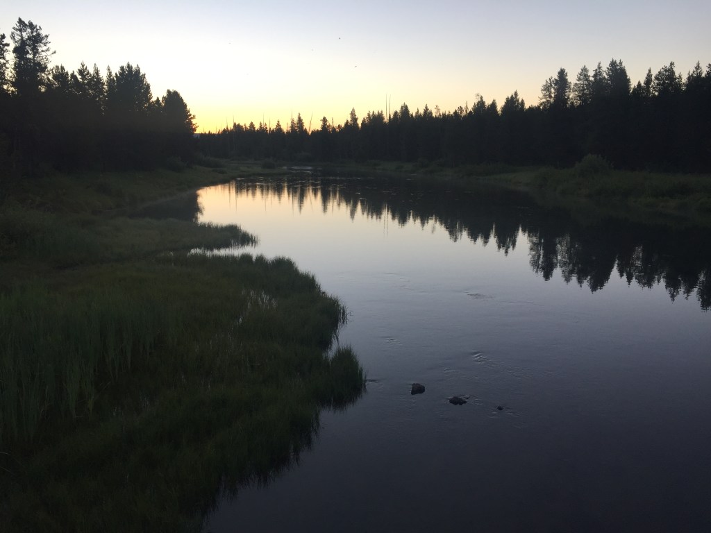
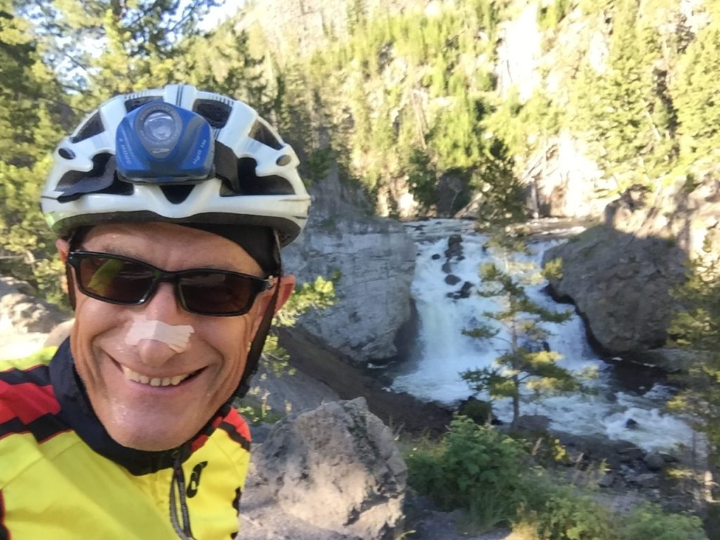
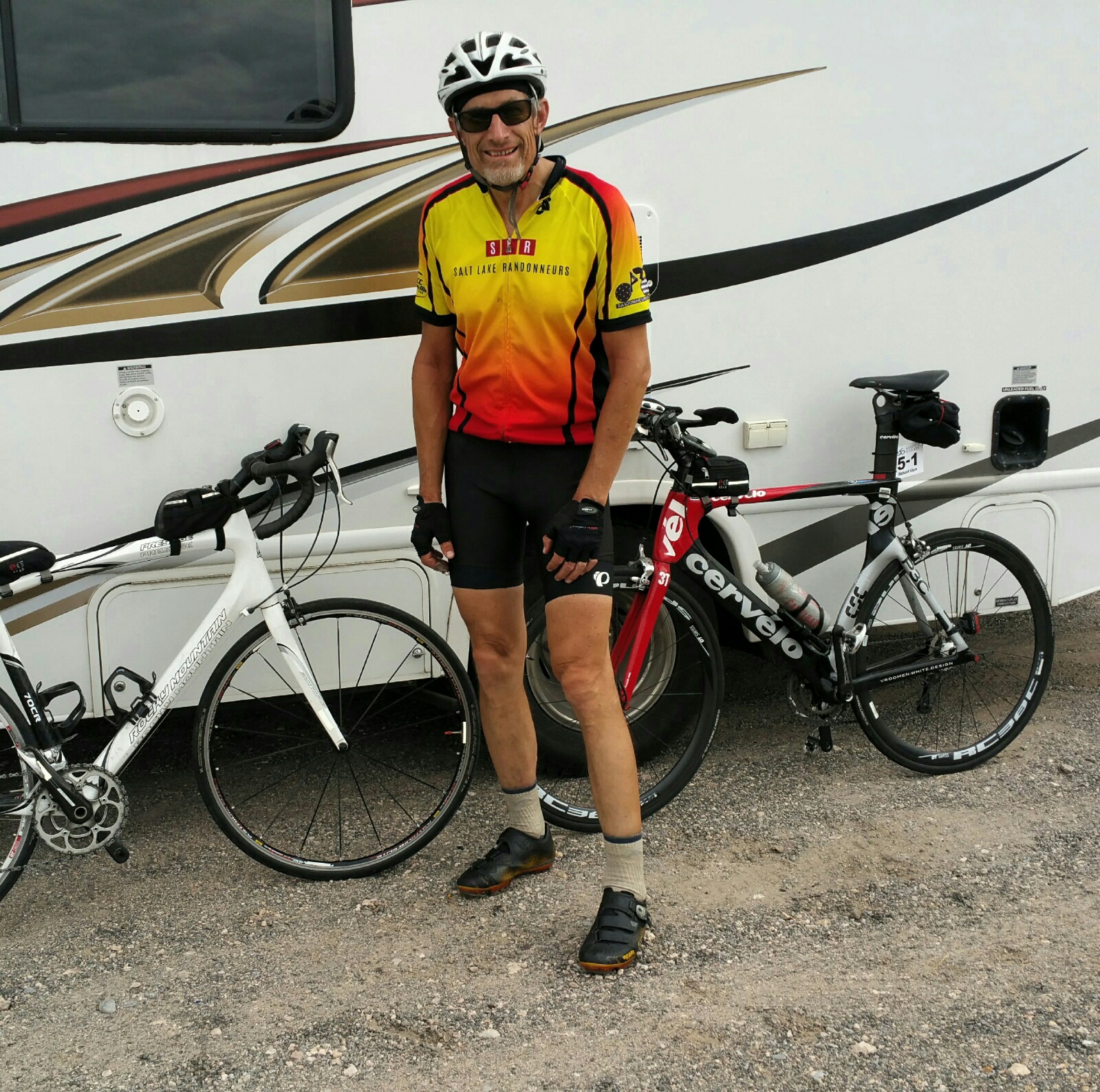
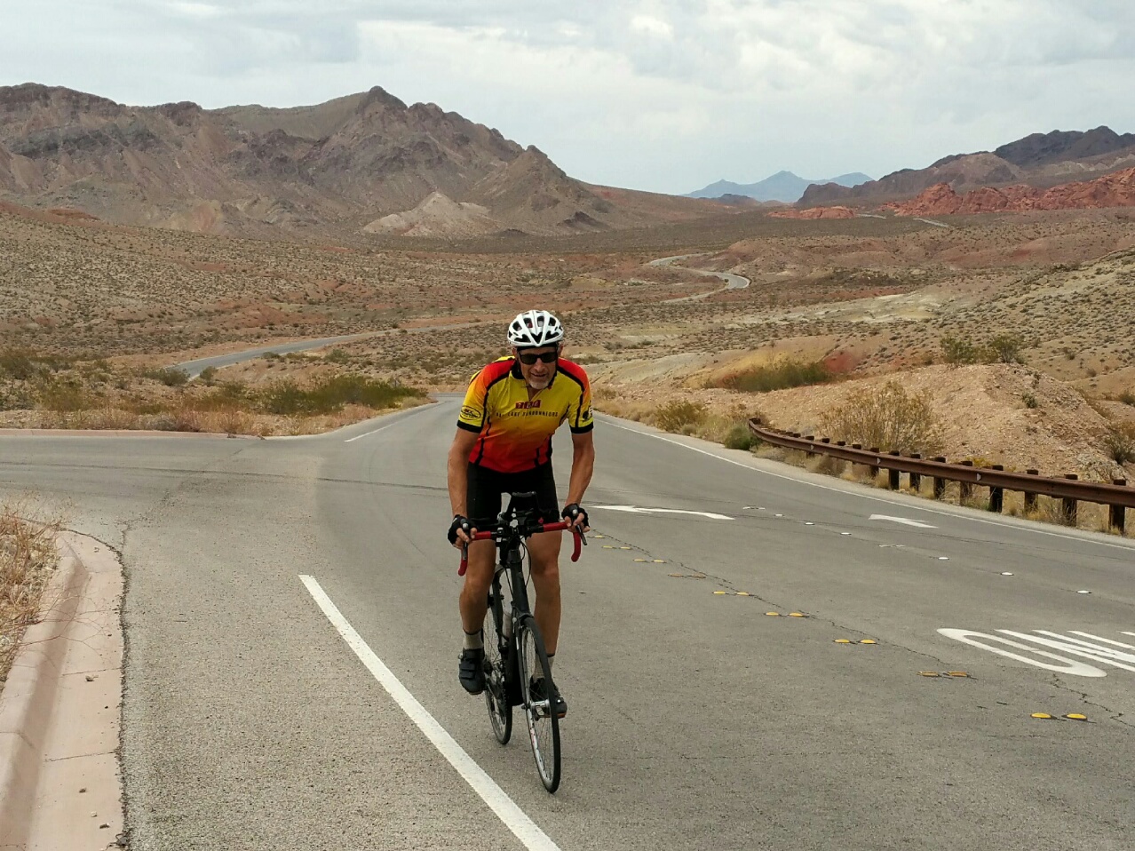
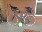
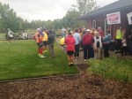
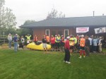
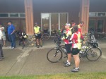
At the start.Just north of Ashton…predawn. First climb of the day one.I’m a sucker for breakfast burritos.Day one…THE lodge in Yellowstone.Grand Canyon of Yellowstone.Jim Halay…helping drive support.My rig.eoGEAR bags of course.Supper at the end of day one.Early on day two. Stunning view of the back side of the Tetons. Photo: Paul FoleyFront side of the Tetons.Chilling.More view of the Tetons on day two.Late on day two. Classic shot. Photo: Paul FoleyDay three in Swan Valley.Photo: Paul FoleyLDS Temple in Rexburg…late on our last day.Final GPS specs.Final GPS specs.Brag time.
I’m not sure why they call this the “World” Championships as there are not qualifying events to get in.The numbers of the others in my age group taped to my bars. As it turns out, I only saw one of them once the whole time!Valaerio’s RV & crew.Pit rowPit rowMy pitMyself & the CerveloOpening announcements before the start.Meeting the legend: Valerio for the first time (at the start)Awards ceremony supperGeritol resultsTrinketsScott and BarbaraSunday morning breakfast view. “Oh what a relief it was” being off the bike!
Introducton
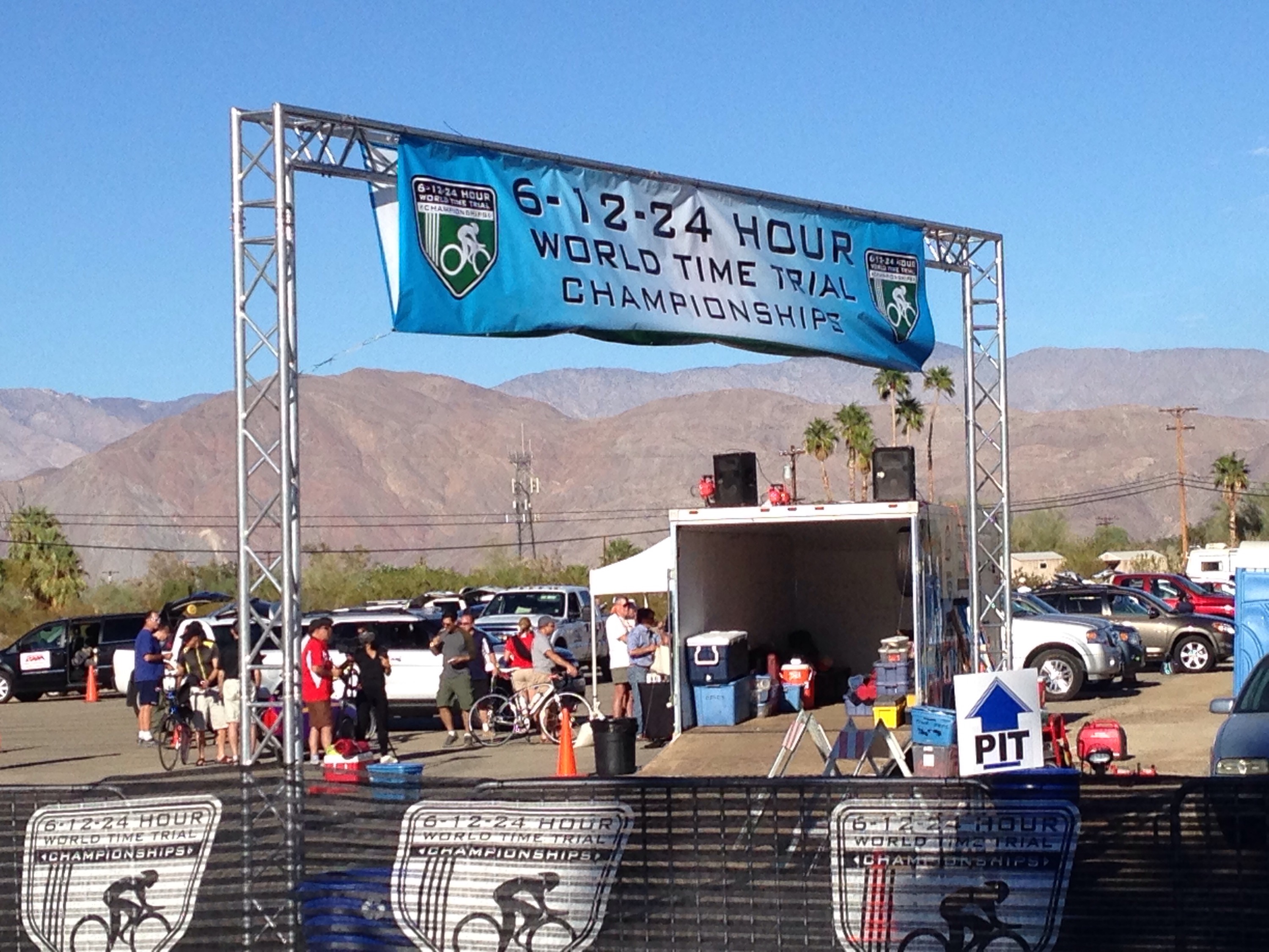
Last year (2014) I did my first 24-hour race, which was this same event, which is held in Southern California in November, about 90 minutes drive NE of San Diego. This, the World Time Trial Championships, is the last of the season in the Ultramarathon Cycling Association’s (UMCA) sanctioned events. Also offered are shorter durations including six and twelve hour divisions.
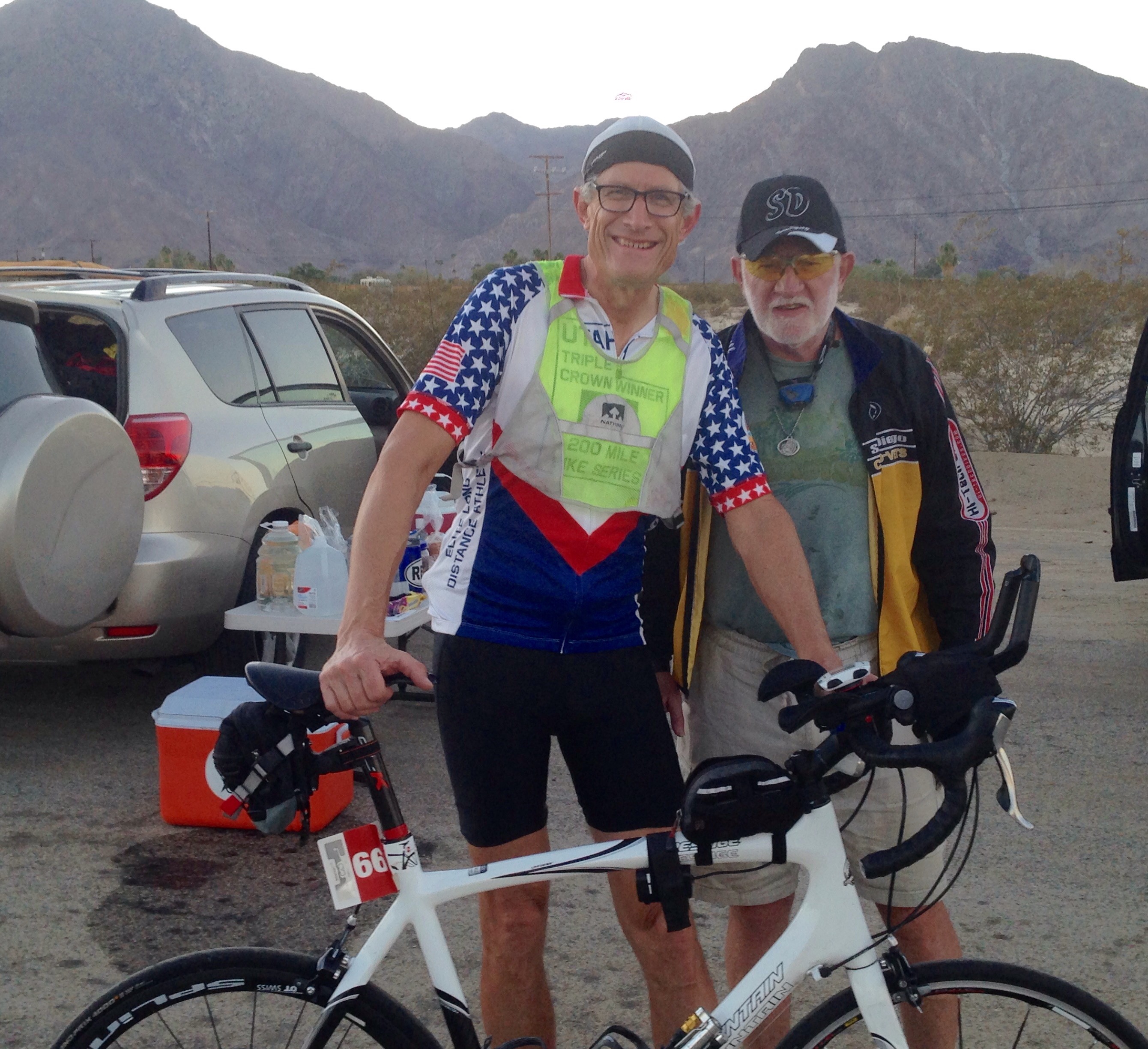
Last year, I placed second (in my age division , 60-65) to Valerio Zamboni, the legendary ultracyclist from Monaco. So this year, I really wanted to see if I improve my standing. Last year, I used a conventional carbon fiber road bike with clip-on aerobars, whereas he, and many others were using time trial bikes. I was kinda surprised how
500-mile GroupDan & myselfStart/Finish LineTiming DudesMyself & Gary GotliebOpening up the bike in the motel.The pits.Pam & Chris Hopkinson “Hoppo,” who had almost 400 miles for the day. The 24-hr winner & 2015 UMCA race leader.Hoppo’s bike.Hoppo and LarryPost race smile.6% grade hill SunriseOne of the few shaded sections along the routeLittle traffic on this route
Pre-Race
On September 25th I rode my first event in Texas — the Texas Time Trials. They are hosted by Dan Discroll, who is also the RBA (organizer) of a local randonneuring group. They are put on in the community of Glen Rose, some 90-minutes SW of Dallas.
I flew in the previous day so I could get my bike assembled and make sure everything was working. This was my first experience in shipping or flying with a bike, so I was a bit apprehensive. I shipped it ahead using the service Bike Flights (via UPS Ground). The cost was about the same as flying with on Southwest Airlines — it was waiting for me at the motel, so I didn’t have to hassle with it in the airport and rental car.
This non-drafting 24-hour “Iron Butt” race started at 5:00 p.m. on Friday. Other events started earlier or later, depending on the distance. Upon my arrival I received a warm greeting from Dan and his co-organizer, Pam Wright. I also meet volunteer Gary Gottlieb, who is a legendary distance cyclist and local randonneur.
During the day on Friday, I just chilled in the shade of the pavilion and pre-loaded electrolytes and fluids. The forecasted high was in the mid to upper 80s. Perfect weather. Since I was flying in, I prearranged to share my “pit” with a friend I met at the Texas Hotter N’ Hell show, Larry Eads. He provided me with a cooler and I was able to share his tent.
I had looked at the route ahead of time online, and unlike the other 24-hour race which I did the prior season, this one had a lot more climbing. I had a 12-30 cassette on my 10-speed carbon wheel, but the cranks were the typical time trial configuration, which is 53-39. I was a little apprehensive that this gearing may not be low enough, especially later in the race, as I tire and my strength drops. The loop was 26.4 miles with about 1200 feet of climbing.
Night Riding
The race started on time and I carried two water bottles on my bike. One on the bottle cage and a 2nd on a jury-rigged insulated pouch mounted underneath my aerobars. This necessitated stopping and pulling it out to switch as I couldn’t quite reach around far enough while clipped in. I started out with Hammer Perpeteum in my main bottle and fig newtons in my eoGEAR Century Deluxe top tube bag. My stomach was a little queasy for the first hour or two, but it later settled down. I did not have a crew person, so the idea was to stop at the “pit” every few hours, or as needed, to refill my bottles, eat solid foods and top off my top tube bag with more nutrition.
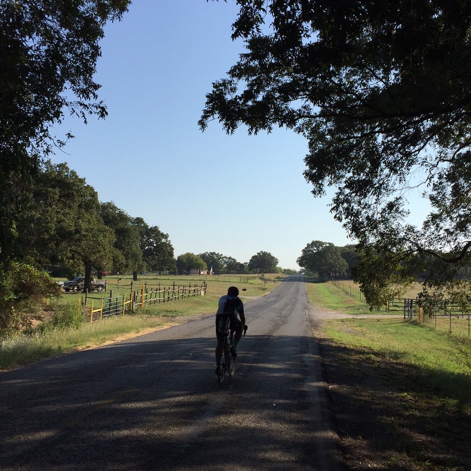
I managed to get in four laps before I ran out of fluids, so finally, after knocking out a little over a 100 miles, I stopped at the pit and topped off everything. In cooler temperatures, I find I can go a quite a distance with minimal fluids, as long as I have sufficient nutrition. The night was so comfortably warm, so that I only needed to add arm warmers. I had a wind vest stashed in my seat bag, but ended up not needing it. What a difference to riding in Utah, where the temps drop down do 40 or 50F at night in the summer or early fall. The key to night riding is to keep moving and not stop for very long, otherwise you will chill and want to put on more clothing, that may cause overheating later on. I did have to be mindful of my battery life of my front “white” light and also switch out batteries during the night. As it turns out, with my Cyglolite 740Xtra, one large and one small battery were enough to get me through the night. Since I was doing the same loop over and over again, I was able to ride with my light on the lowest setting, since I became familiar with each of the turns and stops. At one point, in the middle of the night, I did see out ahead, a “thing” cross the road — it appeared to be an armadillo, but I could not be sure. I would hate to have an encounter with one those with my skinny 25mm-wide tires!
This route had many short rollers (up to 6%) and consequently, I found myself out of the saddle on the climbs and in the aerobars on the flats and downhills, as I tried to build up speed for each upcoming hill. Consequently, I had no “Shermer’s Neck” problems because I was moving around enough on the bike and not constantly in the aero position.
Finally, Daylight
Sunrise finally came and at the first opportunity, I dumped off my lighting gear to save weight. I am rejuvenated by the sun and my pace seemed to pick up a little. Later in the day, it did get pretty hot, but I used insulated bottles and filled them with lots of ice. I don’t mind temperatures in the mid to upper 80s, as long as I can keep cold fluids going down. With the heat, I ended up stopping nearly every 26-mile lap to refill both of my bottles. At one point, I passed another cyclist who was walking his bike on a rather flat section and I asked “are you OK, need anything?” His response was “yeah, I just need a new back!”
As we rode into the city of Glen Rose, the organizers had arranged for a police officer to be at the main downtown light and wave us through, holding up traffic. That was nice as it was at the bottom of a gradual hill. I had no flats or mechanicals, so I didn’t need the roving support vehicles that cruised the route 24/7.
The Results
I just kept on doing laps and ended up rolling into the finish line with 344 miles and about 20 minutes left on the clock. This race offers no short loop option, so if I wanted to get more mileage, I would have to complete another complete lap, which was taking over 90 minutes each and they would pro-rate my mileage for the 20-minutes left. As it turns out, I was the only 60-year old in my category, so I had nobody to “beat,” and I decided to call it quits. That provided me with a 5th place overall finish, out of 18 solo guys (of all ages). 1st through 4 get a spot on the podium.
Afterwards I headed to my motel (across the street) and showered. At 7:00 p.m. was a great banquet and awards ceremony, after which I promptly proceeded to my room to catch up on some badly needed sleep.
Many thanks to Dan, Pam and their many volunteers for sponsoring such an epic event. This is the 14th year for this event. And I extend my appreciation to Larry Eads for taking me under his arm and sharing pit space and his hospitality.
After arriving home, I wrote an e-mail to Dan with the following feedback and impressions of this well-organized event. Most of it is below:
Pro:
No rumble strips on the route (they are MUCH worse than chip seal, which we also have a lot of in Utah)
No tight “dangerous” turns on the downhills. I could bomb them all, as they had decent run outs.
Blinky lights at T intersections was most helpful
Mileage markers all along the route were appreciated
Easy, common-sense reflective gear rules (not as rigid as 24-hour World’s in Boreggo Springs, CA)
End of season timing, which works for me, since I don’t usually start doing long (300K or longer) rides until May
Friday-Saturday riding with no cycling on Sunday (that is due to my Christian religious-convictions)
Con:
This course as a fair amount of climbing for a time trial event. My GPS showed 1,131 feet per lap. I wonder if you had a flatter course, that you might attract more triathletes, which would use this for training purposes (although in September, most are done for the season).
No small “end of day” loop. If you roll in with time left on the clock they allow you to finish one more lap and then pro-rate your mileage accordingly. I rolled in with 20 minutes left on the clock. Mentally, I just couldn’t deal with doing another full enchilada lap (90+ minutes)…and get such a small portion credited to me. Is doing an out-and-back with a turnaround before the Nemo climb, not feasible? With a couple of volunteers stationed there, verifying completion of laps? Too many riders to keep track of? I understand that Bessie’s Creek 24-hour race, also in Texas, has some sort of honor system for doing partial laps.
Dawn at Guardsman Pass, at the top of Big Cottonwood Canyon.
Leaving Heber valley.
Approaching Wolf Creek Pass. It had a nice low-angle grade.
Wolf Creek summit. Climb number two done!
Descending Wolf Creek.
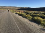
Open range on the descent of Wolf Creek.
Duchense at 2:16 p.m.: 112 miles in, having climbing about 9,000 feet. Averaging only 12.37 MPH. 10 hours on the road.
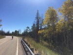
September frequently has many clear days like this in Utah.
Duchense. Time to stock up…next services in about 100 miles!
Climbing up towards Indian Creek Pass.
The descent down Indian Creek Pass. Climb number 3 done!
Purifying water — it was 70 miles between water stops.
Afternoon on day one.
Approaching Scofield Reservoir. The next summit was in the dark and it was cold…so no photo.
Nebo Loop. Climb number 5 done!
Sit down food stop in Utah County.
This I.D. badge must be included on all summit photos.
Prettiest part of the ride: Alpine Loop.
Alpine Loop summit. Climb number 6..
View of the LDS Draper temple, just after topping off Traverse Mountain.
Salt Lake valley at the end of day two. It was kinda nice to be back where there were more frequent services.
Kenneth cathing a few Z’s out of the wind, while I put on some more layers. At Alta Ski resort.
Last climb…summit number 8 at the head of Little Cottonwood Canyon.
Introduction
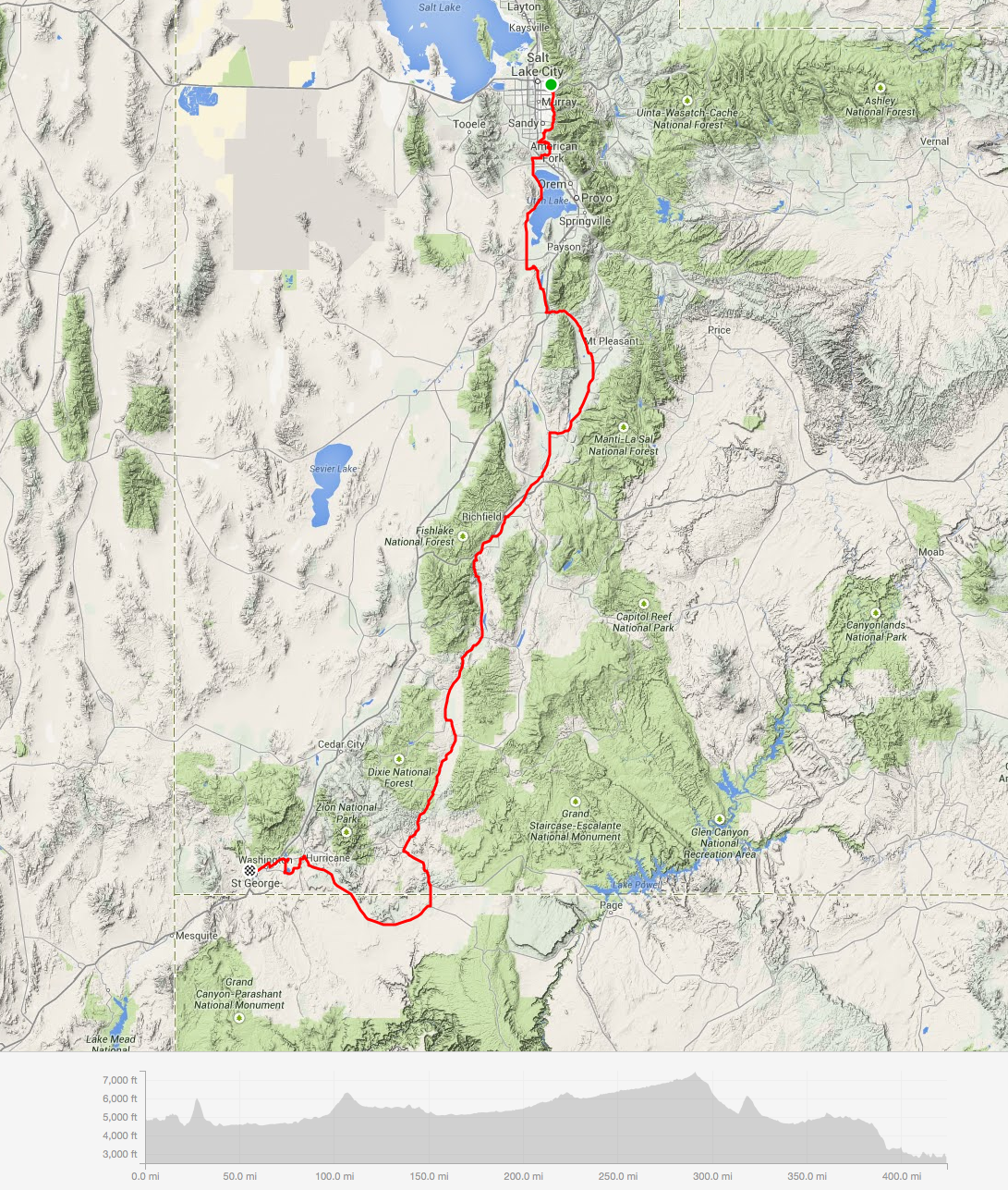
Within the past year or so, the randonneuring world was introduced to a new type of event. It is called a Super Randonneur 600 Permanent, or just a Super 600, as it if most often referred to. SR600’s are permanents, and not a “brevet” which is a scheduled ride. Permanents can be done any time. A Super 600 must be between 600 and 619 km (375 miles) with at least 10,000 meters of cumulative vertical gain (32,808 ft) and must be finished in 40 hours (a few years later, the rules were changed, allowing 50 hours). During the summer of 2015 I beginning designing a Super 600 here in Utah. With our many ski resorts nearby Salt Lake City, we have plenty of canyons and mountain passes. With a lot of help from fellow randonneur (Kenneth Moss, from the Salt Lake area), we came up with this design. The route is officially called the Wasatch Range SR600. It starts in Cottonwood Heights (Salt Lake valley), overnights at my house in Mount Pleasant, and then works it’s way back north to the start.
Day One — 214 miles, Four Major Mountain Passes for a total of 18,600′ of Climbing
At a little after 4 a.m. on September 11th, 2015, Kenneth and I set out to slay this beast. He is much younger than I (I’m 61), so he had to exercise a little patience on the climbs as I could not keep up with him. We started up Big Cottonwood Canyon in the dark, and with little traffic in the canyon, made our way to the top of Guardsman Pass right at dawn. The temperature was nice at the start, around 55F and quickly cooled as we climbed up in elevation. From the top of Guardsman Pass, we dropped down one of the steepest (and roughest…my tail light rattled off) paved roads in Utah, toward Midway.
We then headed up towards the small town of Francis, just south of Kamas and made our first c-store stop, topping off our bottles and stomachs. From there we headed up and over Wolf Creek Pass. The top of the pass has some campgrounds and we were hoping for water, but since it was after Labor Day, they had already turned off the spigots. We had some reserves and continued down the other side. Eventually, in the small town of Hanna, we found a cafe that was open and stopped in to rehydrate. From there we continued the gradual descent into the town of Duchense and immediately found the local Subway. After Duchense there were no open services until our overnight stop at my house, which was about 100 miles. In Duchense, I ordered a 12-inch sub and only ate half of it, taking the half in my seat bag for consumption later. There was one c-store at about 70 miles after Duchense which reportedly had a water spigot outside their building. Consequently, I brought some Potable Aqua iodine tablets to purify water along this section. Kenneth, on the other hand, choose to purchase extra water bottles and stuff them in his jersey pockets. Before the ride, I carefully examined the route using satellite view and find some possible water sources near the road. I stopped several times on the descent of Indian Creek Pass trying to find the ideal spot, which I finally did, near the bottom of the descent. I refilled two of my bottles (I brought a screen strainer too) and added a few tabs in each and proceeding along. It was now late afternoon of the our first day.
After Indian Creek Pass, we made our way onto busy U.S.-6, but only for a few miles and then started the climb up and around Scofield Reservoir. On the south end of the lake was a sole c-store which was closed (but we new that in advance). It was about 10 p.m. As it turns out, there was a water spigot as promised by the store owner and we both topped off our bottles. We had one more climb ahead of us before the our overnight stop. The temperature was about 48F at Scofield, but it felt a lot colder, due to fatigue. I had already put on my wind jacket. I had arm warmers and a vest underneath. Kenneth only brought a vest and arm warmers, so on the upcoming descents later than night, he was really suffering, due to the cooler temperatures. My GPS registered a low temperature of 36F along the top of Eccles Canyon / Skyline Drive, which we rode through at about midnight. It felt good to be climbing as the descents were so dang cold. We made our way up and finally down Fairview Canyon (top of Skyline Drive), one that I am familiar with, yet Kenneth, who did not know this canyon, but yet with his fat and stable 42mm-wide tires did not hesitate on the descents. He really bombed them. But he waited for me at the bottom of each! His Strava upload showed a maximum speed of 48.5 MPH during our event. We finally made our way to my house, arriving at about 12:30 a.m. My wife had prepared a pasta casserole dish which I consumed. Kenneth’s stomach was not cooperating, so he ate little until the next morning, where he was finally able to take in more calories.
Day Two — 166 Miles, Three Major, and One Minor Mountain Pass for a total of 16,000′ of Climbing
We got about 4.5 hours of sleep and started day two at about 7:00 a.m. At my home, I had an extra cycling jacket which I loaned Kenneth, which he used during the night portions of this final day. From Mount Pleasant, there are about 30+ miles of rollers to the base of the Nebo Loop. We started our climb up the south side of this mountain (the steepest side of this road with grades hitting 15% for short sections) and it was beginning to heat up, but as we gained elevation it almost cancelled out the heat, so this ascent wasn’t too bad. After descending Nebo loop (which has three or four false summits), it dropped us into Utah County and things were really hot now (85F?)…but frankly, it felt good, after the prior night’s cold suffer-fest.
We stopped at a local hamburger shop in Spanish Fork and had a long sit-down lunch. We then rode across the valley towards Provo Canyon, did a short out and back part way up the Squaw Peak overlook road, before finally heading up the Alpine Loop road. I have done this loop from the other direction, but not from this side, so it was enjoyable to riding new terrain. It goes past Sundance ski resort and travels by Mount Timpanogos, a peak which I frequently ski-climb. By now, it was late in the afternoon, so most of this climb was in the shade — perfect conditions for a long ascent. By now, my lower back was giving me fits on the steepest grades. At the “less steep” grades of 5–8% my back was fine as I could turn the pedals just a little quicker. Before this trip, I upgraded my cassette from 12-30 to a 12-32 (my crankset is 50-33). That was simply not enough. I should have gone with a 12-36, but didn’t want to change out derailleurs. Live and learn. Kenneth, on the other hand, had much lower gearing and didn’t have any such issues. I managed to get through this climb without getting off the bike, except perhaps once, at a water break.
After the Alpine Loop climb and descent, we stopped at a c-store and replaced some much-needed calories. The sun was now setting, so we donned our reflective gear and heading up the short Traverse Mountain climb. On the other side of this climb, shortly after starting the descent, great views of the lights of the Salt Lake valley came into view. I stopped a few times to grab some photos. Kenneth, quickly descended, but patiently waited at the next turn, as he was familiar with this part of the route—I was not. We were now in Draper, a suburb in S.E. Salt Lake and had a “mere” 34 miles left. But we also had one of the roughest climbs left—Little Cottonwood Canyon, which topped out some 4,200 feet above. There were no services until the finish—I was worried about not having enough water and topped off one of my three bottles from a sprinkler that was running in someones yard (I ended up not needed it, as it was rather cool, once we entered the canyon). The actual canyon is eight miles long and has a consistent grade of 7 to 9% with some sections at 12-13% (my GPS light was off to save battery life, so don’t know what it actually read), but no flat sections giving one break. The bottom is steeper but near the top it backs off a little. At this point, despite takings a lot of ibuprofen, my lower back was really killing me. I was only moving at 4–5 MPH in parts. The only fix was to dismount and stretch. Afterwards, I could ride pain free for a few minutes before it started up again. I stopped perhaps six or eight times, but did finally catch up to Kenneth, who had paused earlier to add some more layers. We were now at some of the buildings of Alta Ski Resort (one of the few resorts in Utah that disallows snow boarders…so yes, this IS a true “ski” resort). I was getting cold, due to a light breeze and the higher elevation, so we stopped in a vestibule entrance of Alta, out of the wind, where I put on additional layers. From there it was just a few more minutes climbing to the upper parking lot of Alta, our final control. WE MADE IT. FINALLY! No more climbing.
The rest was all downhill and back to our 24-hour c-store. We arrived there a little after 2:30 in the morning for a total time of 45:36. 50 hours is the time cut off, so that was never a concern for us, but then we managed to pick a weekend with flawless weather (cool, but not freezing nights, fairly hot days; little wind; no precipitation in the forecast) and neither of us had any major mechanical problems.
Summary
Would I do another Super 600? Only if I get some lower gearing and the weather conditions are “just right” as it was for us. Having a partner that is fast enough to make the climbs at a decent pace, but willing to chill a little while waiting for me is helpful. In hindsight, I’m sure Ken would have brought more clothing. The forecasted low was about 45-50F at elevation, but for some reason the Eccles Canyon/Skyline Drive was cooler than that, dropping to 36F.
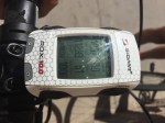
On our second climb on day one, Wolf Creek Pass, it had very little traffic and so we frequently rode side-by-side up this section. I explained to Ken that I was deliberately holding back on my speed up this gradual climb, as I wanted to keep an eye on my hear rate (which is displayed on my Sigma ROX 10 GPS, which is mounted on my handlebars). I was trying to keep it around 70–75% of my maximum, so as it not “burn any matches” before the last day. Typically, on shorter events, I try to climb with my heart rate between 80–85%, sometimes hitting the low 90s. When cruising the flats or gentle rollers, it usually runs at about 70–75%. On our last climb of this ride, I was lucky to get it up to 70%, as it was hovering about 60-65% of my maximum.
Miscellaneous Specs
Passes, in order of appearance. With the maximum elevation and elevation gain for each pass.
Guardsman Pass (top of Big Cottonwood Canyon) 9,791′ (2984 m). Gain of 5,277′ (1609 m) from our c-store which was several miles below the mouth of the canyon.
Wolf Creek Pass 9,485′ (2891 m). Gain of 3,259′ (993 m).
Indian Creek Pass 9,068′ (2763 m). Gain of 3,553′ (1083 m).
Eccles Canyon (a.k.a Skyline Drive), 9,413′ (2869 m). Gain of 1,780′ (542 m) for tallest summit, but several other shorter climbs.
Nebo Loop 9,345′ (2848 m). Gain of 3,530′ (1076 m) for tallest summit, but several other shorter summits.
Alpine Loop 8,060′ (2457 m). Gain of 3,557′ (1084 m) with a shorter intermediate climb thrown in to bring the total climbing up to the mandatory 10,000 m.
Traverse Mountain 6,135′ (1869 m). Gain of 1,336′ (407 m).
Little Cottonwood Canyon (i.e. Alta ski resort at the top of this dead-end canyon) 8,724′ (2659 m). Gain of 4,200′ (1280 m) from Draper. From the mouth of the actual canyon it is “only” 3,333′ (1016 m).
The “gain” spec is the amount of continuous climbing from the base of each climb.
It is possible, that this is one of most difficult SR600s worldwide, due to the fact that it has five passes over 9,000 feet and two over 8,000 feet. This may have the highest “average” mean elevation of any SR600. If you take an average of the seven passes over 2000 m, it is 2781 m (9,124 feet). Because of this, randonneurs traveling from regions at lower elevation would be well advised to acclimate a week or so prior to attempted this route.
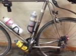
Gear I used: 60cm Rocky Mountain Prestige all carbon road bike with a mechanical 10-speed 50-33 crankset (the 33 is a special chainring which uses the standard 110 BCD; made in Italy by PMP) and SRAM PG-1070 12-32 MTB cassette. Rim brakes. DT Swiss alloy 1450 rims with Continental 4000 S II 25mm tires. Prologo Scratch Pro (143mm wide). No aerobars. Sigma ROX 10 GPS with chest-strap heart rate monitor. eoGEAR 6.6 Roll-top bag with add-on 2.5 pouch, mounting using a prototype lightweight dual bracket. Pearl Izumi MTB carbon fiber shoes (X-Project 2.0) with SPD cleats & Shimano A520 touring clipless pedals.
In 2014 I rode in my first-ever supported long-distance race, called Salt to Saint (Salt Lake City to Saint George). It was primarily a 420-mile relay race, but there were a handful of solo riders, like myself, that rode. It went OK and I finished well before the designated cut-off time. That ride had a lot less climbing and was shorter than this event, which goes from Salt Lake City to Las Vegas.
Early in 2015 I started looking at the stats for the Saints to Sinners. Only one solo person, Mike Conti from Park City, had finished this ride. The allotted time was similar to Salt to Saint, but it had 100 more miles and lots more climbing. I knew I would be hard-pressed to finish in the normal 36-hour cut-off. Early in the year, while at an outdoor expo, I asked Steven Tew, the organizer, if he would be willing to extend the 36-hours for solo riders. He agreed and I later decided that I would start three hours earlier than the relay riders or solo riders. I extended an invite to several of the other solo guys to join me at 2:00 a.m. but they declined and wanted to start with everyone else at 5:00 a.m.
This race mandates a crew and I was lucky to have two friends help me: Jim Halay of Eden, Utah and Frits Tessers of Mount Pleasant (my home town). On the evening of July 30th my crew camped out in Jim’s RV at the start line. I had with me three carbon-fiber bicycles: a Cervélo P3C time trial bike with aerobars, a Trek Domane, also with aerobars, and a Rocky Mountain Prestige without aerobars. The idea was to use the TT bike on the rollers and less-steep terrain and then switch to the Rocky on the climbs. The Trek was a back up.
On Friday morning we got up at about 1:15 a.m. and were able to get me moving by 02:00. The first 214 miles to Panguitch are rollers with little climbing, so I started on the TT bike with the other two bikes stowed away inside or attached to the RV. It was a nice temperature of about 60F. Heading south out of the Salt Lake Valley there was little wind until I hit Saratoga Springs and along the shore of Utah Lake, at which point, I had a slight headwind. It was breezy all the way until the sun came up and then the wind tapered off. I was able to make it to Panguitch with an average moving speed of 17.45 MPH, which I was pretty happy for. I was deliberately keeping my heart rate low (70-75% of my max.), as with such a distance, I didn’t want to “burn up any matches.”
GPS at Panguitch some 214 miles in.
Jim and I at the Panguitch rest stop.
Upon arriving in Panguitch I slammed down some serious calories and switched bikes, as the biggest climbs of the trip were right ahead. Having a crew with an RV was wonderful as they could prepare food in advance and have it ready, so I can eat and run. Jim and Frits were most helpful throughout this event.
Killer scenery, on the way out of Panguitch.
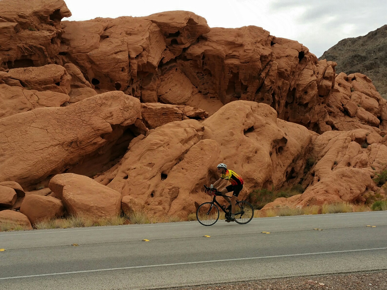
I started the climb out of Panguitch. At that point, with a three-hour head start, no one had passed me yet, but I knew, sooner or later, the fast relay guys and some of the solo guys would. About half way up the Cedar Breaks climb a relay cyclist finally passed me (like I was standing still!). This was the middle of the day and it was slightly overcast, which was wonderful as it was not too hot. I worked my up the first major climb, descended and then made the final ascent to the Cedar Breaks summit. It was well before dark. I took little time off the bike during this section. I just wanted to get it over with. It was nice to descend down into Cedar City in daylight. Upon arriving there I laid down in the grass next to the RV (with my feet up on a chair to get some of the blood to drain back down) and ate a bagel sandwich, macaroni salad etc. My crew in their RV would leap frog me constantly throughout the trip. It must have been fatiguing for them as they had to do a lot of waiting around.
It was just starting to get dark as I left Cedar City and many other cyclists were coming and going now. My crew switched my main light back to the TT bike and I headed out west toward Enterprise. I ended up riding this bike all the way into Moapa Nevada. In hindsight, I perhaps should have switched back to my “climbing” bike in Enterprise, but my pedaling cadence seemed OK with this bike, despite it having slightly higher gearing, so I just kept on it. Climbing on a bike is weird at night because most of the time (unless their is a full moon) you cannot see the hill or judge the grade. I had done this climb once before, but it had been a few years. I just turning the pedals and made a moderately fast descent down from Vejo into Santa Clara, near Saint George. From there it was a long and gradual climb up Utah Hill, which was the old highway to Las Vegas, before they put in the interstate. It seemed to never end. I saw were few other cyclists and I couldn’t see the summit as the road was curved. Along this section I finally gave it and consumed some caffeine gum to keep me alert as I rode through the night. Although I could have taken a power nap in the RV, I wanted to push on without one, to save time. The descent off Utah Hill is a very long and rather steep one, but since it was still slightly dark (dawn was breaking), I was fearful of “outrunning” my lights, so I kept my speed to under 35 MPH. A bit frustrating in a race!
Jim’s RV: Our home for 3 days.
Closer shot, showing my two primary bikes used on this event. Yes, 25mm-wide tires on both. A “plastic” Prologo saddle on the Rocky and a narrow Fizik TT saddle on the Cervelo.
My crew didn’t shoot any photos until the very end, hence I was on the black Trek “back up bike.”
Entering red rock country in Neveda.
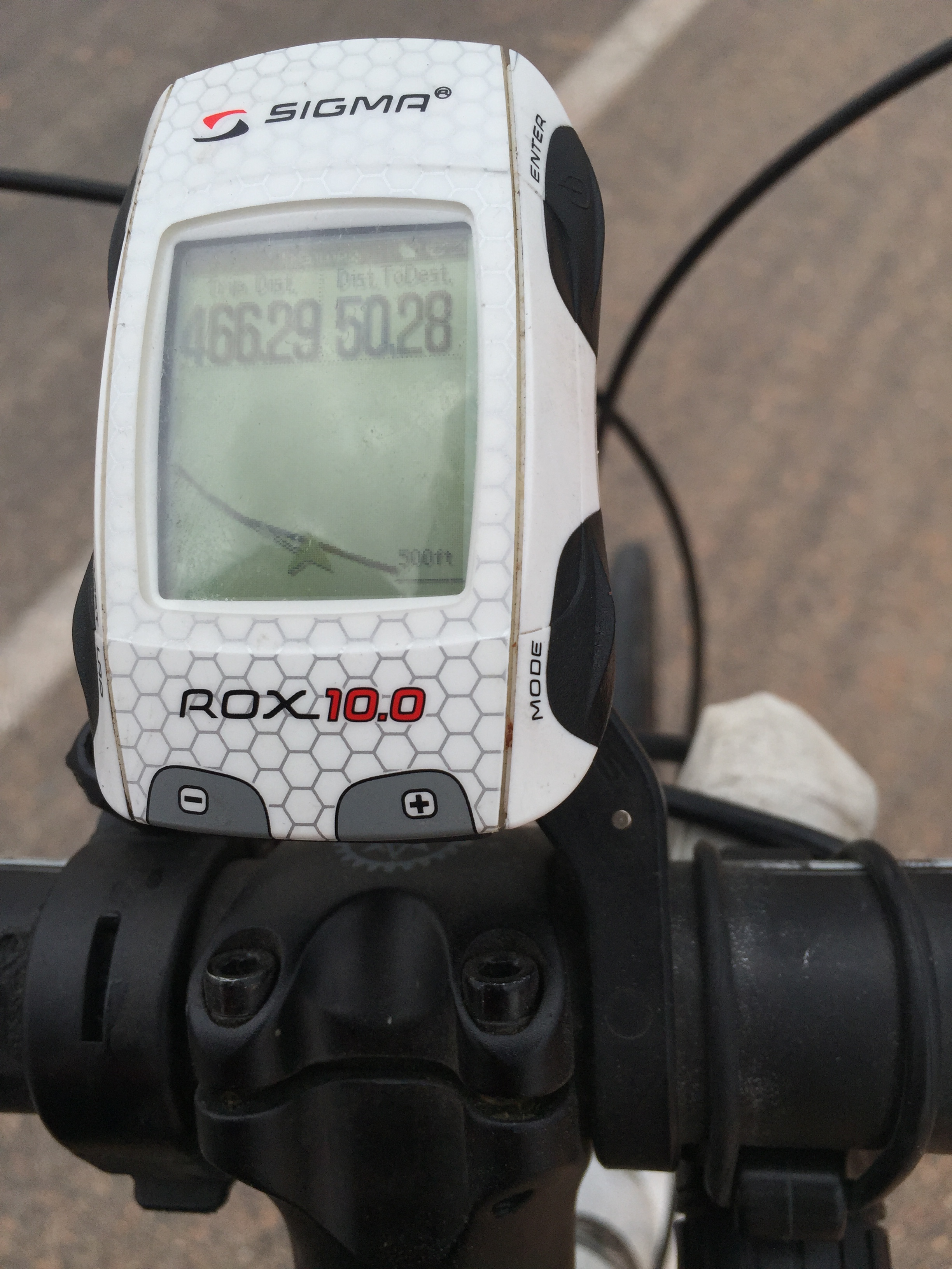
Throughout the morning, I rode along a highway and side roads near I-15 until arriving in Moapa Nevada, where I switched back to my climbing bike. At this point, my maximum heart was topping out at only 65% of my maximum. I was moving pretty slow, but it was consistent. After a series of climbs I arrived to the entrance of Valley of Fire state park. My GPS indicated that I had traveled some 466.29 miles and I only had 50.28 miles left. That seemed OK, except that my GPS indicated that I had only climbed about 14,500 feet so far. The entire route, according to the online maps, indicated 22,000 feet total. Others that have ridden this route said that their GPS indicated it was closer to 20,000 feet, depending on your GPS model. Regardless, that meant that the last 50 miles had approximately 4,000 to 6,000 feet of climbing. I was NOT a happy camper! This last 50 miles is on a road that seems to go nowhere, except that it had repeated climbs and descents, with seemingly little purpose, as it worked it’s way southwest towards Las Vegas. It sits a few miles off from the shore of Lake Mead, but most of the time one cannot see the lake. It was a death march.
At one point, when I had just passed my support vehicle, my rear derailleur cable snapped. I waved down my crew and we made a quick switch to the back-up bike, which I used for last 35 miles. Fortunately, it had the same low gearing as my climbing bike (50-33 in front and 12-30 in the rear). I was worried about excessive heat here during the last 60 or 70 miles as one approaches Las Vegas in the middle of the day in August. But it turned out to be overcast with some light sprinkles no less. THANK GOODNESS.
GPS at the entrance to Valley of Fire state park. 466 miles down and “only” 50.28 to go.
Near Lake Mead
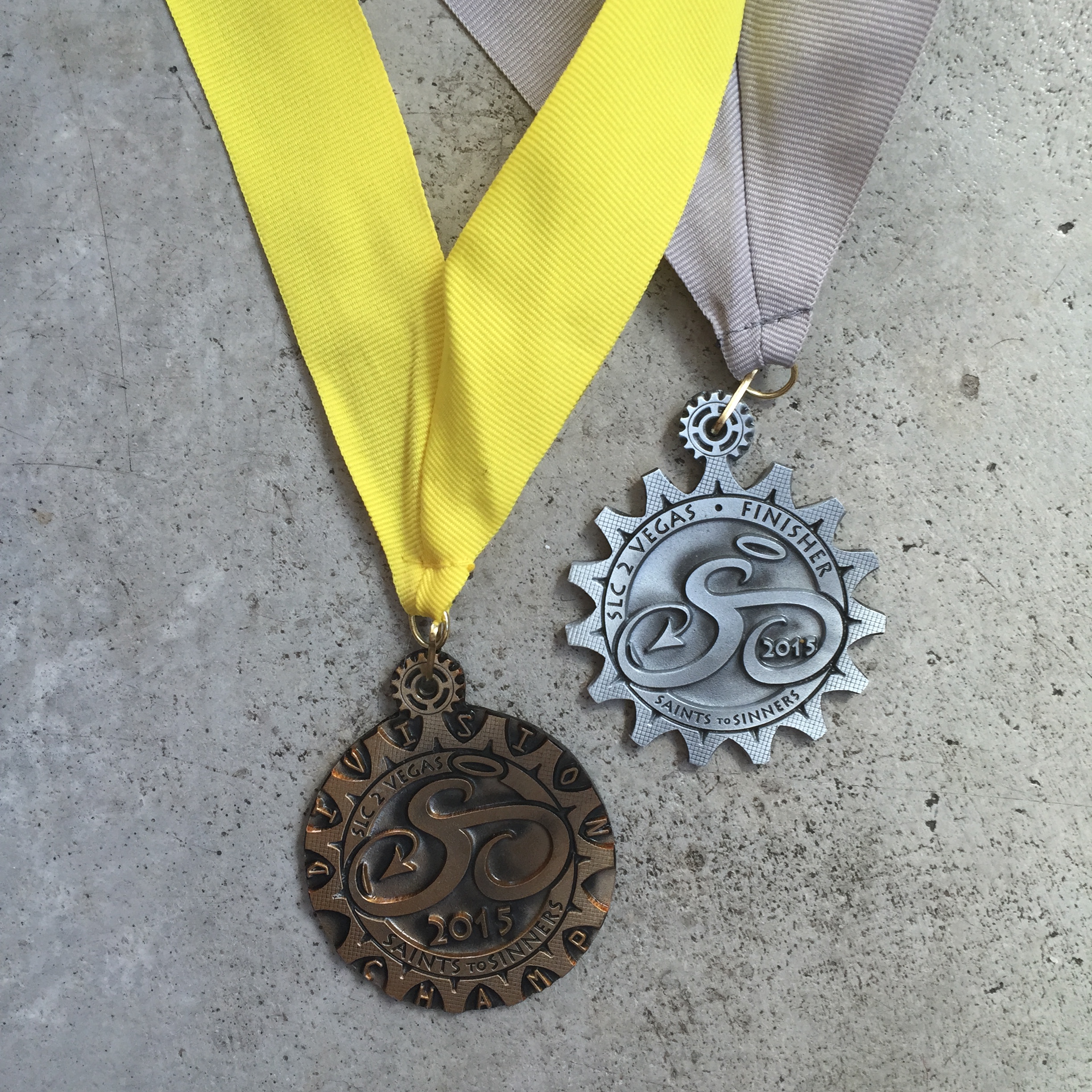
After hours of hill climbing and descending, I finally made it to the finish line. The awards ceremony had just finished and their were folks still there taking pictures in front of the finish-line banner. They informed that I was the only solo finisher and gave me two ribbons: one for finishing and one for taking first in my category. This was later proven wrong as there was one other solo rider, Russel Mason, who was still in transit. Some volunteer had received information that he had quit, but this turned out not to be the case. He left at 5:00 a.m. and later arrive at the finish line, with a faster time than I. As it turned out, Russel and I were the only solo riders to finish this year, making us two of only three to have finished this event as solo riders.
So would I do this event again? Personally, I would like to try a similar event as a “rando” self-supported style ride, but it would take me several more hours, so I am not sure that is feasible for my age (61) and fitness level. Also, the last 50 miles, with all the climbing, was just too much uphill packed into end of such a long event. The relay riders were more fresh, so for them, this last segment was not as brutal. After the event, I kept looking at the online maps, wondering how the organizer could change the route so it entered Las Vegas without taking on this last onerous climbing section — I couldn’t find anything, other than the interstate or a very busy trucking highway (with little shoulder).
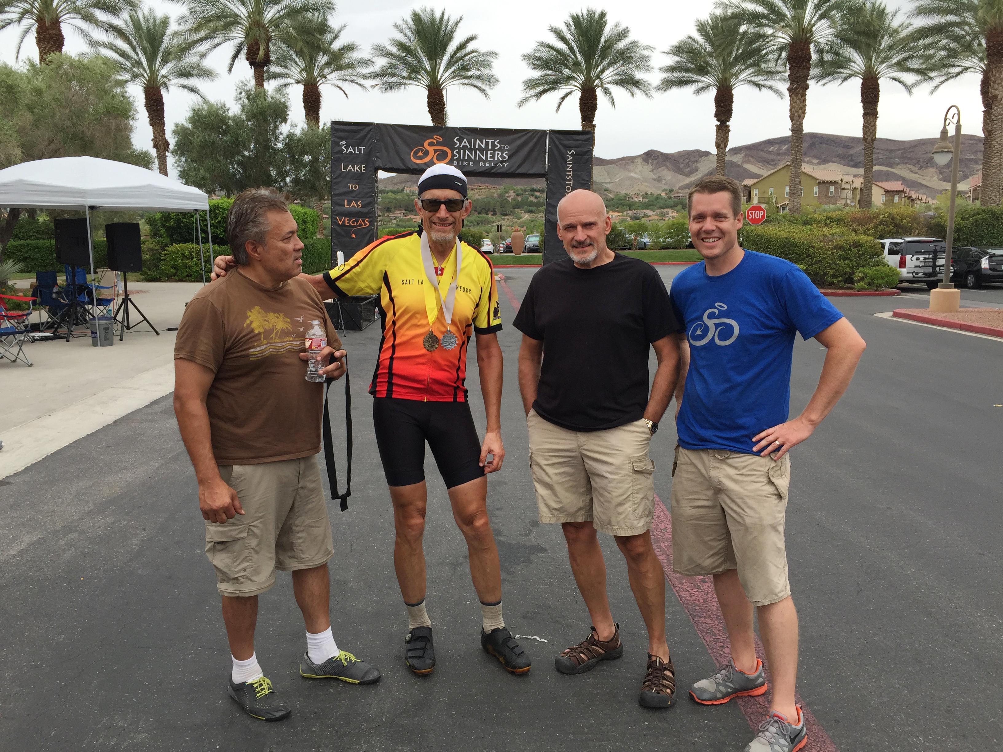
Many thanks for Jim Halay for the use of his RV and for the ever encouraging words, help and advice of himself and Frits.
Frits, myself, Jim and Steven, the organizer, at the finish line.
Total time: 37:51. Moving time was 33:58, which means I was off the bike 3:53…seems like a lot of time of the bike!.
That was 2nd place to Russell Mason, who had a time of 36:32.
On June 8, I rode one of my annual long rides of the summer. This is one that I facilitated and is a 1000 km ride out of Kanab Utah. I will be doing occasional posts during the ride on our Facebook group: Facebook.com/groups/saltlakerandos
The route has some 28,000 vertical and the finish time is 5:30 AM on Thursday morning. The mileage is about 620.
Brief summary: Eight riders doing the 1000K, one doing the 600K and four doing the 400K, all starting at the same time (02:30).
Day1: Joe Edwards went off the front, so Kerin Huber (whom I have ridden with in the past on long events) and I went with him. We had a bit of a tail wind as we traveled west to the Saint George area, arriving at our first checkpoint at around 6 a.m. From there we did an out-and-back to Zion National Park and then climbed our way up through Cedar City and through the Parowon Gap, a BLM site with petroglyphs. We had some support on this day, i.e. water at key points along the way. We arrived in Panguitch, our overnight at dusk or about 9 p.m.
Day 2: At approx. 4 a.m. I sent off, in pursuit of Kerin, who had already left earlier in the morning. I caught her on the climb to Bryce Canyon and stayed with her most of the day. My favorite spot there was Fairyland Point, which looked great in the early morning light. From there we went north to the small town of Junction and then made the long ride south on U.S. 89 back to Kanab. I drafted off Kerin during much of the headwind as I was feeling a little bloated from a heavy sit-down breakfast earlier in the day. I also started feeling some saddle pain. After another stop in Panguitch, her stomach started feeling crappy, so she ordered me ahead and not to wait for her…which I did. I saw her later in the evening near Coral Pink Sand Dunes state park. I arrived back in Kanab at about 10:00 p.m. She rolled in about an hour later. The rest of the group, which had stayed together, came in about 2 a.m.
Day3: After a decent night’s sleep, my butt was really feeling it. I was ready to call it quits, but Spencer Klaussen said “it is only 160 miles to glory…tough it out.” So I slapped on an extra pair of shorts for more padding and started taking doses 600 mg of Ibuprofen. I left at about 7 a.m. Once again Kerin was ahead of me and I caught her on the climb and went by. Shortly thereafter I flatted. It was raining. I was in a hurry — faster cycling meant “less painful hours in the saddle.” Anyway, I made it to the North Rim of the Grand Canyon, but the view was obscured by heavy rain and clouds. Eventually, I made my way back to Kanab, arriving at about 9 p.m.
After this ride, I ending up with a new kind of saddle sore — a lump under the skin near my left sit bone. After a few days of it not going away, I started taking some Amoxicillin (left over from a dental visit which I never used). But it didn’t seem to be doing much, so about a week later I paid a visit to my local physician. He prescribed Cleocin and a heavy dosage of Amoxicillin, both antibiotics. Unlike previous saddle sores that were more superficial, this one was lumb or abcess, well under the surface of the skin. Meanwhile, I am off the bike for a bit until this heals completely.
Teams could ride together and draft if they wanted.
Willie and his full-faired machine.
My support man: “JB Harward.”
The start and finish line.
Most of my cycling is randonneuring/self-supported ultra-distance events. But towards the end of the summer of 2014 I ended up doing some non-rando races, which included LoToJa (206 mile sanctioned road race) and Salt to Saint (420-mile relay race, which I did solo). It was kinda fun doing these events as they are supported, enabling me to travel with less gear and a lighter bike, which translates to faster overall speeds.
In November of 2014 I participated in my first 24-hour race, which was called the 6-12-24 Hour World Championships. It was a time-trial race where the individual riders could not draft. The objective was to ride as many loops as possible within a given time time period. Everyone started out doing the big loop, which was 18 miles and with about 300 vertical feet. Then, during the last few hours, the organizers switched everyone over to a smaller loop, which was 4.75 mile each.
Next to the start/finish line was a parking lot where everyone provided support “tail gate style” for the duration. Most riders had family members or friends provide support, but one rider, who self-supported, ending up placing 2nd in his category— he just had having everything carefully laid out on a table. Many thanks to my friend JB, which helped keep my bottles filled and food ready. I stopped in only when I ran out of fluids, which was after four or five laps. I stuffed as much nutrition in my jersey pockets and top tube bag as good—at a recent event, I ran out of solid foods before running out of fluid, so I made a point of stocking up here.
My goal was to maintain an average speed of 17 MPH, but at the end of the day, I wasn’t even close, partially due to stiff winds during the last 3 to 5 hours of this event. The event started in the dark, at 6:00 p.m. Friday evening and continued until 6:00 p.m. on Saturday. I used my carbon bike (Rocky Mountain Prestige) with clip-on aerobars (as opposed to my Ti frame). I used the Fizik Kurve Bull saddle, which I had used earlier in the season for some 10 to 12-hour events without issues.
There were five riders in my age group (doing 24-hour). My average speed was only 15.4 MPH, with a total of 361 miles (my Strava link). My moving speed was 16.3 MPH with a top speed of only 30.6 MPH (a rather flat course). That placed me 2nd (60-69) behind the legendary Valerio Zamboni, who logged in some 397 miles. I ended up with 82 minutes off the bike, taking food breaks and switching out clothing—way more than I had hoped. Valerio, by comparison, was off the bike only 38 minutes. On this day, my Fizik saddle starting hurting me (soft tissue, not sit bone problems) about 18 hours in. I had prepared another saddle, already mounted up on a post, in the event I decided to change, but I never took the time to swap them out. Instead, I just kept on suffering, until about 23.5 hours, at which point I had enough, as I was doing a LOT of standing due to the pain. I quit the race with 30 minutes left on the clock. I ended up doing 19 of the main laps and 4 of the shorter laps. The temperature range for this day was about 48 to 75F—perfect cycling temps.
Here is a nice blog report as found on the UltraRaceNews.com site.
I was surprised how many riders were using full-on time-trial bikes instead of a regular road bike with clip-on’s like I had. Many of these same riders do RAAM, but during this event, most do not use TT bikes. I am guessing that is due to all the climbing involved with RAAM. I am interested in doing more of these events and have acquired a used TT bike frame for this purpose next season. I just wish these events weren’t so far to travel as there are none in Utah or neighboring states.
Route from SLC to Saint George. 425 miles & a moderate amount of climbing (approx. 15,000 ft.). My official time was 28:41.
In 2014 I got the idea to ride in a local 420-ish mile relay race, except NOT doing it relay style, but riding in the “solo” category. Salt to Saint is the name of these event which goes from Salt Lake City to Saint George Utah. Unlike many multi-day events outside Utah, this one did not conflict with Sunday, so I decided to give it a try, starting on Friday, September the 19th. Unlike some other relay races, this one allowed aerobars, something I use a lot on long road rides. Having done several longer brevets this summer, I knew what my average speed is for events lasting 400 to 600 km (250 to 375 miles) and I figured I could easily finish within the 34.5-hour cut off time.
I organized a crew, and, as mandated by the organizer, I needed two crew-support drivers for the night section, but only one during the day. My local cycling friend JB Harward consented to drive the first section from SLC to Sanpete County, where we live. For the balance of the ride I got help from two other local friends: Paul Hart (who introduced me to the ultra-endurance world of running) and Frits Tessers (an all-around guy that knows a little about lots of sports). I picked up my packet and these monster car stickers the previous night.
All the solo riders started at 8:00 a.m. JB was more nervous than I as he doesn’t know Salt Lake and managed to get lost, trying to follow the route. Early in the ride, there was a big climb up and over Traverse Ridge, so I started off with with my carbon-fiber bike, as it is lighter, due to no aerobars and a lighter-weight saddle. JB and I hooked up at Transition Zone two, some 33 miles into the course. At that point, I switched to my Seven Titanium bike which had aerobars and off I went to make the distance around the west side of Utah Lake. JB met a local friend there (Russell) there, who rode with him (in the car) for the rest of the trip to Sanpete County. I was not able to find other riders that were close to my speed when making my way around the lake, so I ended up soloing the whole thing. As I entered Juab County (near Nephi) I did find some help for perhaps 8 or 10 miles, and that was nice.
From there I climbed up Salt Creek Canyon to the slightly cooler temps of Sanpete County, where I live. JB & Russell met me at the transition zone in Fountain Green (mile 111), after which he left to switch crews. My next crew caught up with me near Manti at about mile 139. I rode all the way down US-89 and the we actually had a slight tail wind coming into Salina, which is atypical. It was nice going 22-25 MPH during much of that section. I also was able to draft off another relay rider before I flatted just outside Salina. I texted my crew who were nearby, and quickly come to my rescue, switching out wheels.
I was surprised how few people I was able to draft with. There were about 490 registered riders, but only 9 doing the solo version (7 finishers). The starts were staggered, based on your predicted finish time. When I did come upon another rider I would quickly mention to them I was a solo rider and they all let me “suck their wheel” as they were only going around 16 miles for each leg (unless they were doing double legs). But honestly, that only happened about 4 or 5 times for a few miles each.
As nightfall came, I added on my lighting gear and reflective clothing. This was just as I was entering Richfield at about 7:00 p.m. (mile 181). From there I continued to ride my Ti bike until we got into Hatch (mile 279), which is near the base of a long, slow climb up to a place called Long Valley Junction. There I switched bikes and stayed on my carbon bike the balance of the ride. One section of the roads was wet from rain, but it had happened just before I arrived. The high that day was in the mid 80s — perfect cycling temps. The nightime temperature at Hatch was a warm 48F, but it felt much colder to me due to my fatigued state. Consequently, I put on my winter soft shell jacket and neoprene booties, as well as some warmer mountaineering gloves (having a crew close by was wonderful!). There as a slight head wind for most of the night. Cycling down US-89 at night was great! No, really. Aside from the support crew cars & RVs, there were very few vehicles. Earlier this year I did another ride (a long brevet, which I organize), going down US-89 during the day, and we were weaving in out of the rumble strips as vehicles approached us. It was tedious. On Salt to Saint, my crew choose to shadowing me (driving slowing behind me with their flashers on), which kept me alert and moving. There were unbelievably helpful during this whole ride.
I finally arrived in Kanab at 6:00 a.m. (mile 332) and although my crew had a lot of food in the car, I wanted something hot, so we stopped into the local McD. The service was slow as there was also were a couple of 4-man crew trucks with riders going through the drive-thru. While waiting for my food, I rested my head down against the table and got a 5 or 10-minute power non-sleep “nap.” Dawn was just beginning to break as we left Kanab. I still had on all my warm clothing, finally removing it as the morning went. I quickly arrived into Fredonia Arizona, after which there is a long gradual climb to Colorado City. This section of the highway had a decent shoulder outside the rumble strips. But as soon as we entered Utah, the shoulder shrunk down to nothing (see photo). Here my crew shadowed me again, plus I got a free draft from another relay cyclist. We dropped into Hurricane Utah and it was now getting pretty warm. It was 10:30 a.m. I removed all my extra clothing. I realized that with my remaining mileage, I would not be able to achieve my goal of a sub-28 hour ride, but pushed on hard anyway. I went straight through for the next 31 miles (much of it had a bunch of short climbs) without any additional hydration from my crew, arriving at the finish at 1:41, yielding a final time of 28:41.
Overall, the neutral support was OK, but I only used it once their services once to top off my bottles and another time using their porta-potty somewhere along US-89 in the middle of the night. Most of the transition zones were about 18 miles apart — I usually stopped at every other one to top off my bottles or switch out clothing. Some of these areas has porta-potties and others had none (that I could see). At the finish line, their was fresh cut watermelon, pizza and sodas/or bottled water. Because this was a “race,” I took few photos so I could keep moving quickly.
Upon arriving at the finish, Clay, the organizer, indicated that to date (since 2010?), I’m the oldest cyclist to complete this ride in the solo division (age 60). Hurray — an unofficial course record!
Gear Tested: As a bag designer and owner of a niche-market online cycling store (eoGEAR), I’m always testing new gear.
– I had just picked up a new tail light, 1-watter, called the Radbot 1000, by Portland Design Works. I had it mounted to my seat stays. Additionally, I had a 1/2-watt Sigma Tail Blazer attached directly to my ankle. My drivers reported that this combination was “hands down” brighter than any other tail light combo they saw that night!
– Accelerade. I have used Hammer Perpeteum for many of my longer rides as it contains the “magical” mix of 4:1 carbs/protein (most sports drinks have no protein) — but I am not crazy about their flavor choices, so I decided to try Accelerade in tropical punch. That flavor was reasonably tasty…more so than the Cytomax tropical punch, so I most likely will c0ntinue using this product on future riders longer than three or four hours.
– Cocoanut Macaroons. Not everyone likes food with cocoanut. But I love it. And Bicycling Magazine suggested it. Everything we read is true…right? So I tried them and loved them. They are less messy than fig newtons and are less prone to drying out. I shoved four or five of them in the Fuel Container in my eoGEAR Top Tube Century Bag for easy access. Are they a good source of nutrition during an ultra-endurance event? Beats me. Sometimes, just any calorie is a good calorie.
Paul (left) and Frits — the night dream team! Stayed awake all night. Note our “unlucky” 13 rider number.
Clay Christensen, the organizer, at the finish.
JB & I in Fountain Green.
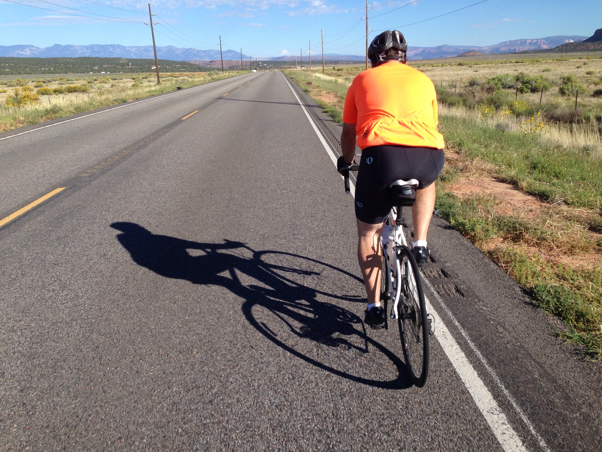
Stretch west of Colorado City — zero shoulder with 65 MPH traffic!
Moose visitor center on day 1 at the bottom of Cameron Pass
End of the first day…just at dusk.
Snowy Range (WY) just before a big hail storm at the top.
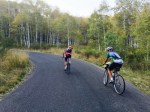
Day 1, back side of Snow Range..riders warming up.
Kerin bunbled up for wet weather.
My wet weather apparel.
Food spread in Steamboat Springs.
More goodies.
And more.
Muddy bike after two days of rain.
Dawn on day 2 going through Yampa
Day two climbing (Kerin)
At another pass on day two.
Various bike types
Descending
Willow Creek Pass on day 3
Tammie doing her food majic.
Problems with custom soles required some field adapation.
Day 4 at the Moose visitor center again (Peter).
Peter warming his hands.
Last checkpoint of the ride!
John’s heavy load.
Me at the finish.
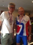
Jim Halay, also from Utah, receiving his medal from Foon.
Jim and I.
This year my annual 1200 km grand randonnée was in Colorado from July 15-18th. It is called the Colorado High Country 1200. Here is the Ride with GPS online map and my Strava upl0ad, made after the ride. (750 miles with approx. 33,000 feet of climbing over 3-1/2 days).
As always, this will be a Twitter-like report. To see a photo larger, click through twice to make “it” happen.
I decided to “use up” one old tire and put it on the back rim, which had kept me flat-free for the past several thousand miles that spring. But as seems to be tradition with this ride, I got two back-to-back flats about 70 miles in on day one. I was carrying a spare tire and swapped it out, later disposing of that tire. Because of this flat, I fell behind many of the riders I would have like to hang with. This year, the climb up Cameron Pass was dreadful, due to tons of biting black flies. Kinda like horse flies, but smaller. Dozens of them all over my legs and arms, but oddly not my face! I thought that as I climbed up to cooler temps, they would dissipate, but they didn’t.
The first two days we had unseasonably cold weather with blowing hail, rain, thunder and lightening. Crossing over into Wyoming, we had a nasty crosswind, which later produced pea-sized hail. Earlier, I left the Walden, a supported checkpoint, with Luke Heller. We alternated working in the wind, as best as possible in cross winds. His stomach started bothering him, so at the last town before the overnight, a few of his friends caught up to him and I kept on moving on, arriving at about 9 p.m. to the motel, just as it was starting to get dark. The mileage that day was about 219 miles.
After a good breakfast, day two started at 3:30 a.m. with a monster climb (3,500 ft?) up to Snowy Range. At about 4:30 I started to pass many others, which had left in a big at 3:00. Eventually I came upon, Kerin Huber, a tough rider from Calif. She and I rode together the rest of the day. Near the summit of this climb, her speed dropped off and I continued on to get caught in a heavy hail/rain storm right at the treeless summit (a cold 38F). It hit when she was near a forest service restroom and ducked in there for protection from the elements. I quickly put on my helmet rain cover and climbed through it all. I already had on my Craft waterproof/breathable jacket. I was shivering so much on the descent, that my front wheel was wobbling a ton. Others reported having the same problem. I later stopped on the descent, down in the protection of trees and put on Rainlegs. I finally made to Centennial and stopped in a c-store to warm up and feed. From there we continued to Laramie and eventually over Rabbit Ears Pass (with thunder and lightening) and down to Steamboat Springs. Throughout the day, the weather alternated from warm and sunny to rainy and cold. Kerin and were constantly changing layers to keep up with the ever changing conditions. I arrived well before sunset and was able to get some much needed rest and food. The mileage that day was 199 miles.
Day three started at about 4:15 a.m. Kerin had left earlier as I was slow getting going that day. The forecast was much better. I passed a few groups as dawn was breaking and came upon Kerin again. We rode the first half together, working together on the flats drafting and sometimes side-by-side talking. Later that day, my knee started hurting, which was a totally new problem for me, I had her ride on ahead of me, while I tried to fix my problem. I usually have saddle sores, but rarely other issues. I thought it must be the height or angle of my saddle and started to fiddle with it several times to little avail. So just ingested more “vitamin I” to mask the pain. Part of my elevated sole (to compensate for leg length inequality) of my sole fell off, so I jury-rigged up some wood on my pedal to compensate for this. Mileage on day three was 193.
Day four started kinda late as I really wanted to catch up on some sleep (I started day one sleep deprived, having stayed up late visiting family in the Denver area), so I left at about 5:00 a.m. with my motel-mate, Peter Hoeltzembein, who is from Canada. It was about 37-40F and his hands were freezing as he had only brought short-fingered gloves. We stopped about an 90 minutes into the day at the Moose visitor center (still closed) and his fingers started to warm up a little, but my knee was still bothering me, so I let him proceed alone. On the climb up to Cameron Pass, I discovered the problem. Before this ride, I very firmly (with an allen wrench) set the angle of float on my cleat at a normal 90-degrees. But my heel “wants” to turn in (due to an old climbing injury and subsequent surgery), which frequently rubs against my crank arm. The cleat finally loosened up (inadvertently) enough so my heel could turn inward and my knee pain quickly diminished. But the damage was done, so the rest of the day I had a low-level pain in my pain. At the last checkpoint of the day, I met John Pearch (from Washington state) and we rode most of the balance together. Mileage for the day was “only” 147.
Many thanks to John Lee Ellis, his wife, and others that helped out to make this event possible. As always, it was nice to have a hot supper waiting upon arriving at each overnight and then have a solid breakfast for the next day.
Titanium Seven Axiom Bike outfitted & ready to go.
Riders at the start line — note the misty, rainy weather. The forecast was record-breaking rain at the north end of the route.
Riders at the start line — the big banana is Willie Hunt’s.
Start line including couple from the U.K. on a tandem.
Yummy food spread at an overnight checkpoint.
Sleeping accommodations. Regretfully their was no hot water here during our stay.
False flat.
Gentlemen from Japan who rode a hard tail MTB with full 2.0″ tires…and he finished.
Paceline into the wind, just after the turnaround point of thje ride.
Infamous Janesville Grade…15 or so percentage.
Post ride luncheon in Davis.
Buzz Scher & I at the luncheon.
Here’s my pix from the 2013 running of the Gold Rush Grand Randonnée, held in northern California and sponsored by the Davis Bike Club. This was my second time riding this out and back event and, as expected, the support was phenomenal. The first 48 hours were unseasonably cold with plenty or rain, so I didn’t take many photos during that period of time.
This event started on a Monday evening at 6:00 p.m. After the first 90 miles of flat terrain, the route begins to climb and then finally it descends into the first checkpoint. As I was descending in the dark (I was alone at that point, having been dropped my others) it was blowing rain from my left side (is “blizzard” a word that can be used for a rainfall?). My visibility was horrible as my glasses were totally dripping wet. While making this gradual descent I heard a clang, as I hit some sorta of metal debris. I was traveling perhaps 25 MPH and I immediately flatted. I pulled over onto the gravel or muddy shoulder and proceeded to replace my tube. Shortly, the SAG vehicle caught up to me and assisted with a floor pump — BLESS HIS HEART! A few miles later I arrived at the Oroville checkpoint at about 1 or 2 in the morning, as I recall. After a terrific midnight snack I continued on in the darkness.
I arrived at the next staffed checkpoint in Taylorsville just time for a killer sit-down breakfast…somewhere around 8 a.m. The rain was letting up a little. From there I made my way over the Janesville Road grade (approx. 15%) and down to Susanville. At this checkpoint I met Buzz Scher (from Anchorage AK) and he was looking for some riders to hang with, as the next portion of the ride would be in the dark. He and I join forces and ended up riding most of the balance of the event together. Despite being similar ages, he was stronger than I, especially on the climbs. Ten days prior to starting this event I did a fast 140-mile charity ride in Utah — I wonder if that didn’t allow me enough taper. I typically allow a full two weeks of taper from my last long (100 mile or so) event before doing 1200 km events. We arrived at the Adin checkpoint, after more than 24 hours or continuous riding and finally got a sleep stop and a shower.
After 4 or 5 hours of sleep, we heading out the following morning with a good tail wind heading into Davis Creek. I noticed other riders returning from this turn around point at mile 387, battling the 10-15 MPH headwind, but riding solo. That was crazy. Upon arriving at this checkpoint, I waited a while until several riders arrived and organized a paceline of about 5 riders for return trip into the wind. We picked up one other on the way too. Working together made the job much easier. We pushed all the back to Susanville arriving just after dark for another overnight stop.
The following morning we left at dawn, tackling the steep climb over Janesville. Buzz easily out-climbed me through this section and I later rejoined him. Unlike in 2009, at least I was able to peddle this whole climb, as I had a lower gearing compared to last time (this year my compact double had a 50/33 in front and 12/30 in the rear). At this point of the event, my butt was killing me. This was my first ride over 400km with this titanium frame. This frame just seemed to transmit more vibrations than my carbon-fiber frame (read more about this issue here). I eventually made it back to Oroville before dark and regrouped with Buzz and others (after getting another flat on my front tire again…I later discovered a small gash in my tire, most likely from my day one flat and then booted it). Four of us left Oroville as a group, working together for the last 100 miles on this flat terrain in the dark. Unlike in 2009, the bugs in the Sacramento Valley were vicious this year and consequently we tried to keep our time off the bike short. We arrived at the finish in the middle of night, with a time of 79 hours. I really only took two sleep stops, unlike most 1200s, where I typically took three overnight sleep stops, hence a better-than-average time.
Many thanks to Dan Shadoan (RBA) and the Davis Bike Club for sponsoring this event. The volunteers were most helpful and this year especially, the meals were incredible.
To view many photos shot by volunteer Deb Ford, go to this page (link of pix of the actual ride only — she has links of the pre and post ride things activities too).
Equipment Footnotes: On nearly every long event, I am usually testing something new, for possible inclusion on my site eoGEAR.
Socks — With the forecast of heavy rain for the first 48 hours, I decided to start out wearing a thin (2mm) pair of neoprene socks, instead of using a neoprene or other type of bootie. The booties always seem to eventually soak through and my wool (combined with some synthetics) socks soak through as well. I found that my feet stayed warm, despite continuous driving rain for hours on end and the temps in the lower 50s (possibly upper 40s). The only thing I didn’t like was the squishy feeling when I put power into my downstroke.
Gloves — Finding a warm, waterproof yet compact glove for cycling has always been a challenge. Earlier this summer I started using the types of gloves. One was the Seirus Xtreme All Weather Glove. It has a thin neoprene exterior with a light bemberg or flannel-like (but synthetic, not cotton) lining. This glove worked very well during this heavy rain and provided good dexterity for shifting and pushing the buttons on my GPS and cyclocomputer.
The other glove I have been testing and functions great in rain or cold rides is the Outdoor Designs Summitlite. It is especially good for tall, long-armed folks like me as it has a long gauntlet. It is about half the weight of the Seirus.
The only thing I dislike on both of these gloves is that the liner pulls out when you had gets slightly sweaty and is hard to reinsert. The key is to squeeze on the finger tips when removing them.
Bike Frames — As stated earlier, this was my longest ride to date with a Ti frame. More on that here.
Saddles — Earlier this summer, I have been testing the Rivet saddle line with my Ti frame. It didn’t appear to be quite as comfortable as my Gilles Berthoud Aravis, so I chose to use the GB on this event (but that have been my Ti frame as the problem, not the design of the Rivet). Oddly, after two seasons, I started developing some chafing on the inside of my thighs with the Aravis. I consequently made a compression strap, similar to those I make and sell for the Selle Anatomica saddles and the problems was solved.