Richard Stum’s randonneur cycling, rando skiing & SUP site. @rando_richard
Ptarmigan Traverse
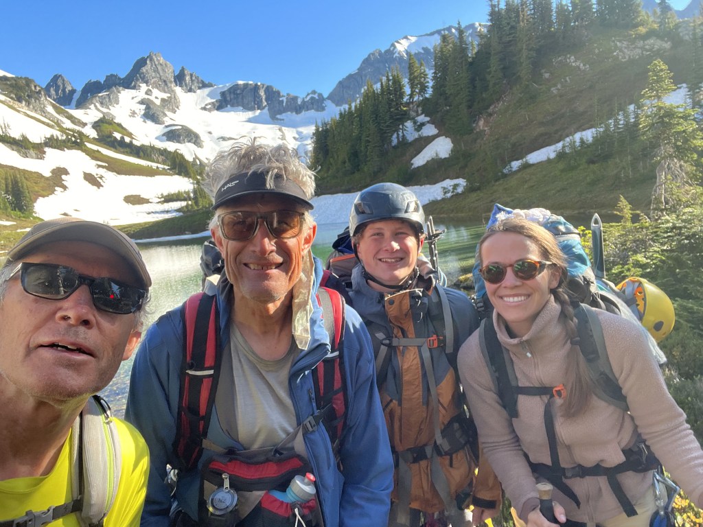
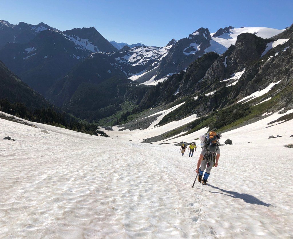
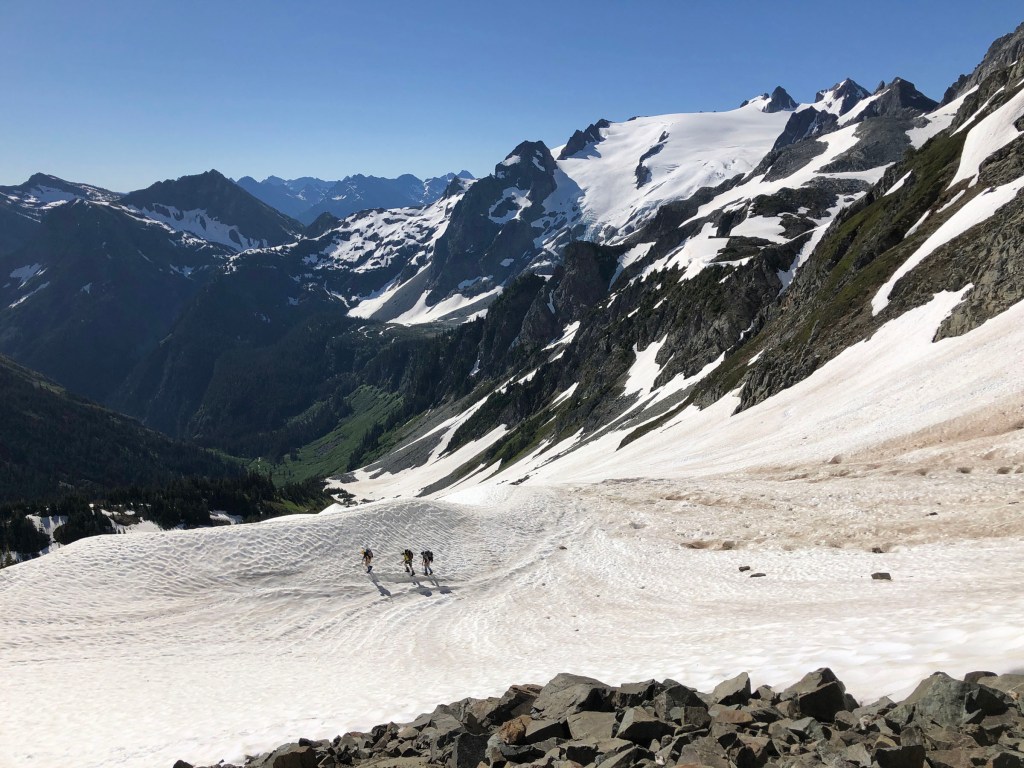
This past July (the 18th–22nd, 2022), myself, my brother Karl Stum, his daughter Corrie Bahr and grandson Aaron Anderson (Natalie Anderson’s son) completed a mountaineering route in the north Cascades in Washington, called the Ptarmigan Traverse. It has been dubbed as “America’s Most Beautiful Mountaineering Route” by Outside Magazine. Our Strava-uploaded stats indicate we hiked or climbed some 45 miles and about 13,000 vertical feet.
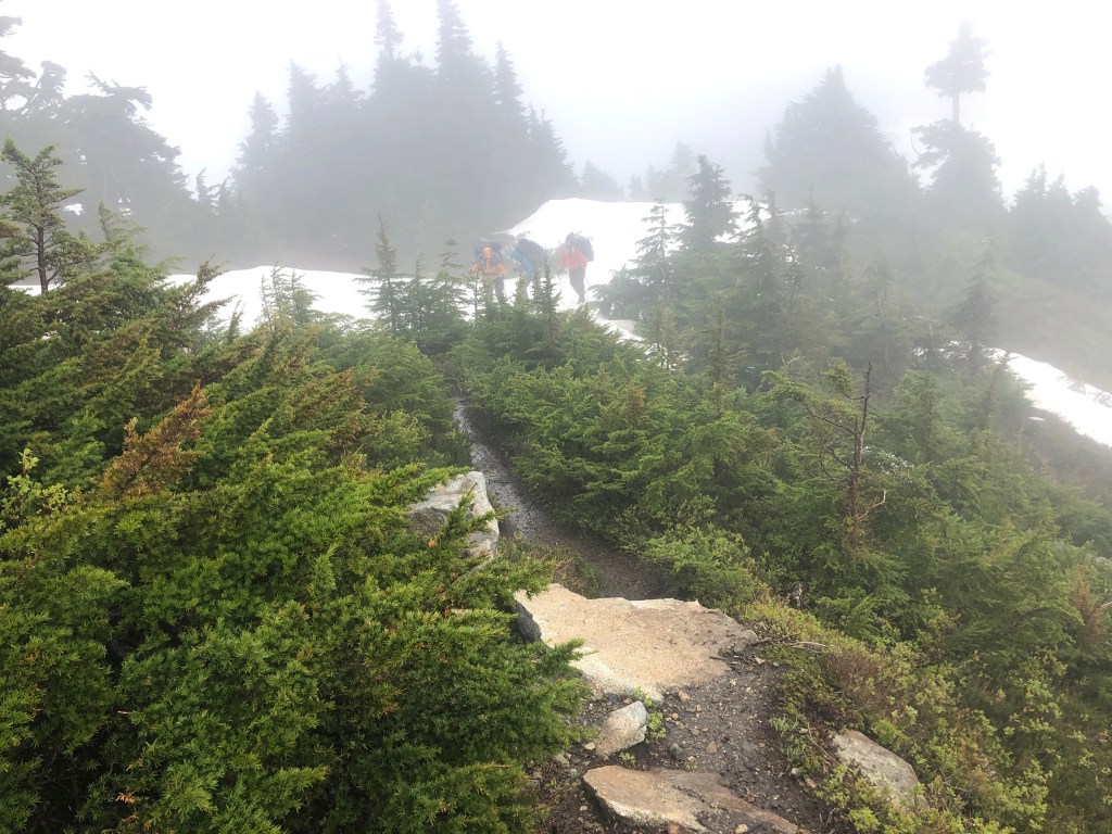
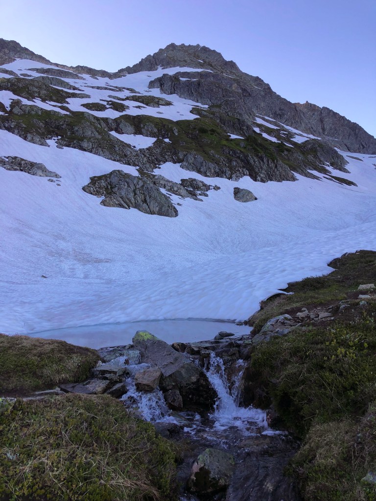
The normal Cascade Pass trailhead was closed, so we started out actual route, some 3 miles and 1500′ vertical down from it. We hustled up that section late Sunday night. It was raining so we opted to camp inside the restroom (it was rather clean!), rather than hassle with starting out the trip with soggy tents. The rain and mist continued into the following day for four or five hours before finally quitting. We had flawless weather the rest of the trip.
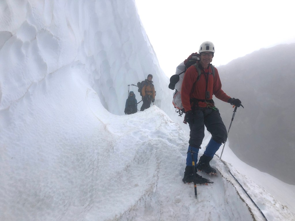
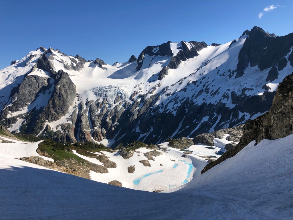
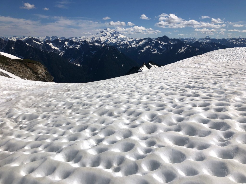
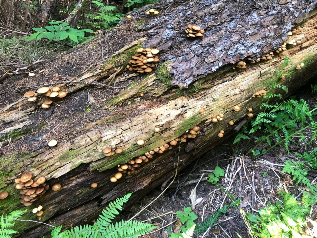
The first four days were absolutely fabulous with much of our route traveling off trail (much of the “trail” was covered by snow, esp. since the winter of ’21–22 had been a big snow year). Because of the many steep snow fields, I felt that technically, it was much more difficult than the standard route on Mount Rainier, though we didn’t have the crevasse dangers found on those higher peaks.
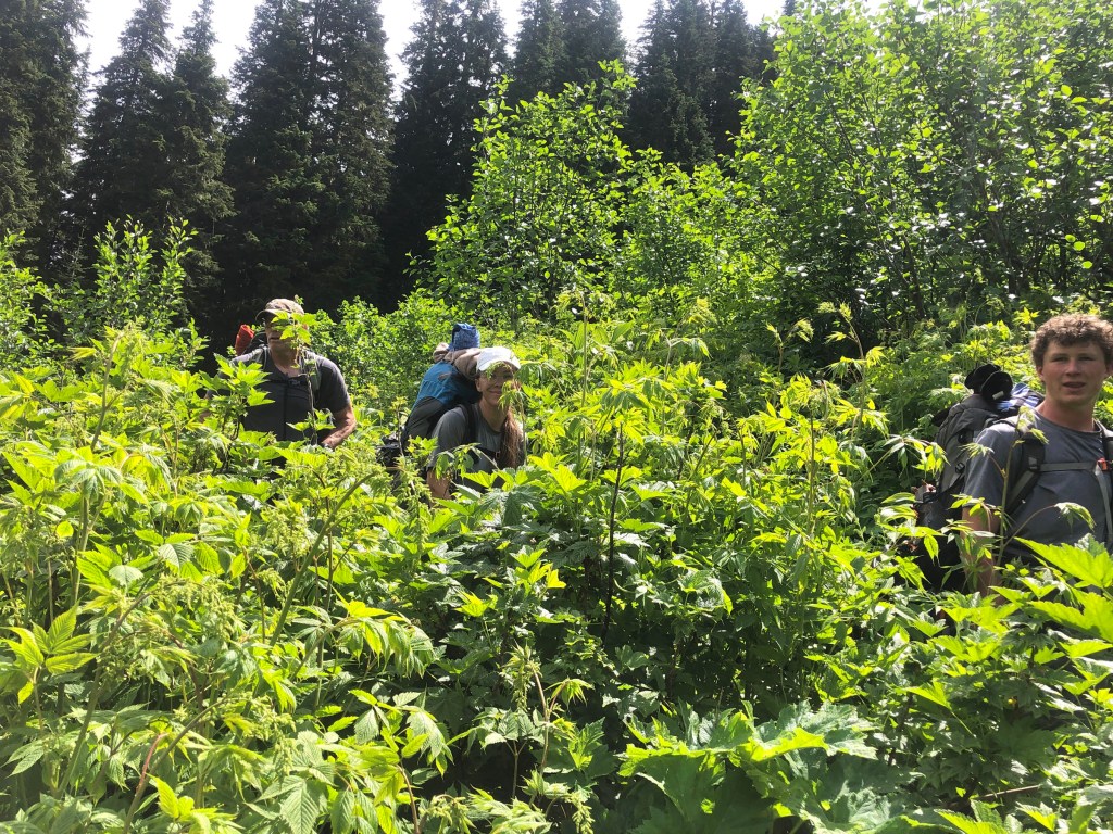
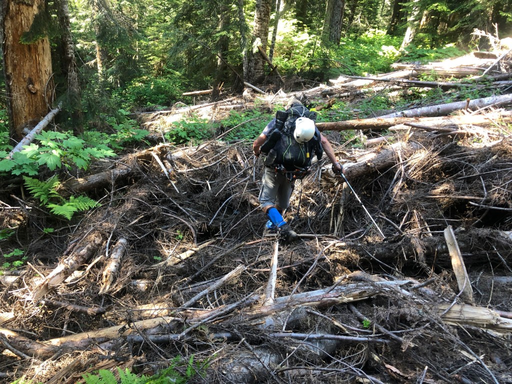
Our fifth, or last day involved hours and hours of bushwhacking on a “trail” that is officially closed; we felt like we were in a Brazilian jungle. Had I known that the last 10–12 miles would have been so difficult, I would not have attempted the route. It just wasn’t worth it. The problem is that there are simply no early bail out options, so one cannot just take a shorter route. The Outside article must have been published many years ago, before the trail was closed. It appears that the U.S. Forest Service has simply let that section of the trail “go to the dogs,” and not make any effort to maintain it.
2026 update: the trail has reportedly been maintained and is now officially open!!
Kyle, a prolific blogger, did this extended route, bypassing the miserable last day (but adds another ten miles). I have recreated his route using my online software. Email for the link if you are interested.
Unless noted, all photos are copyrighted Richard Stum, 2022. Please DO NOT duplicate w/o permission.
Day 1
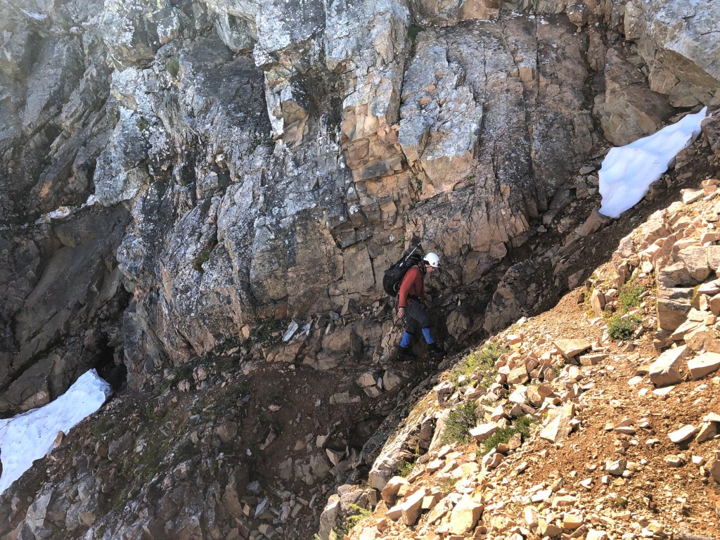
Cache Col headwall. It was melted out on the left side so we went up that side, but it was very steep gravel-like with no way to protect. I lead it using my Whippets to self belay in the dirt.The four of us.Camp at Kool-Aid Lake.Accumulated stats up to that point.
Day 2
Route for the Red Ledges. It was much easier than expected.Leaving the snow and gaining the “ledge.”We all unclipped and dragged the rope. No decent place to put in an anchor.Exiting the Red Ledges and back onto the snow. Ying Yang Lakes.Two brave souls take a dip.Accumulated stats up to that point.
Day 3
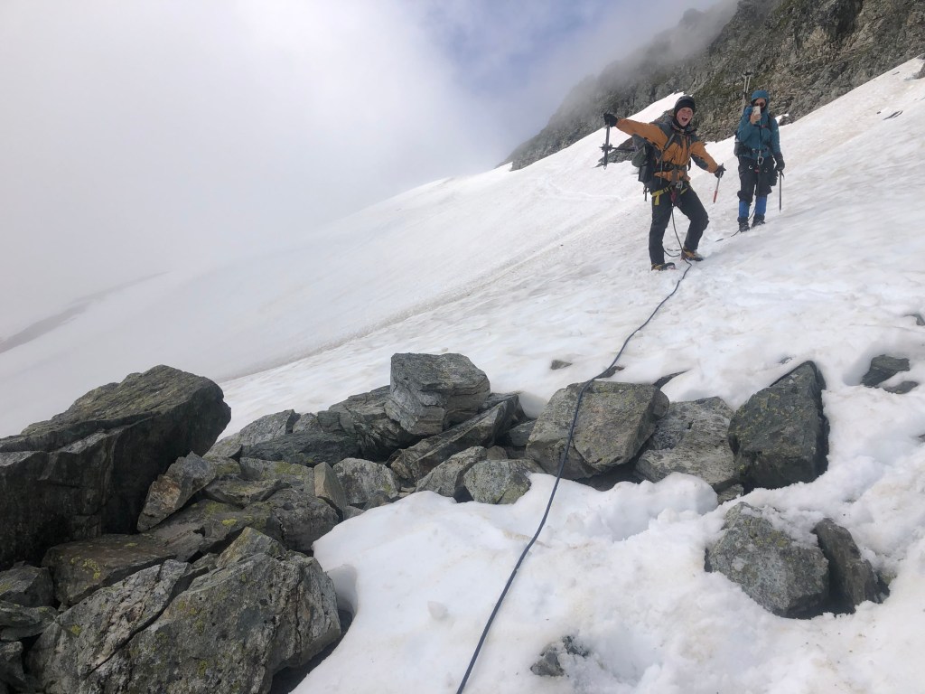
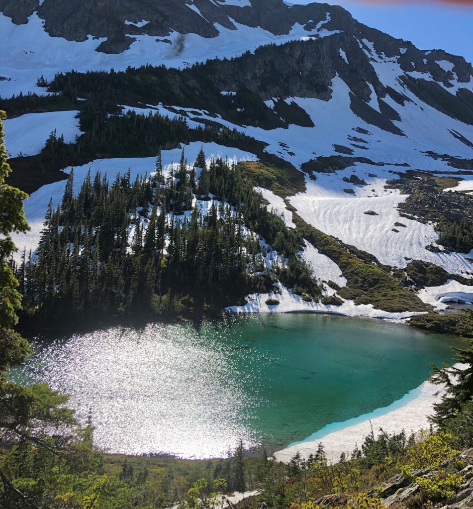
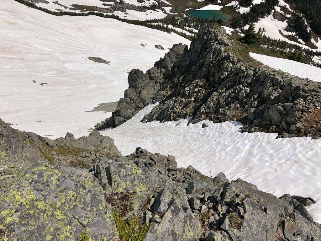
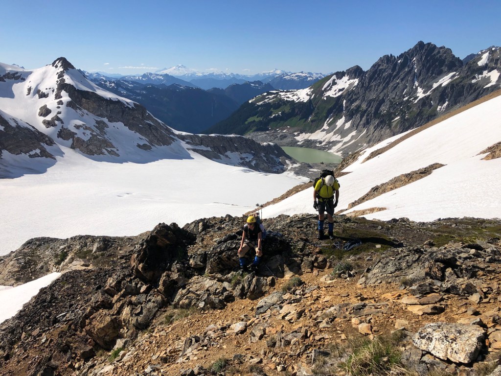
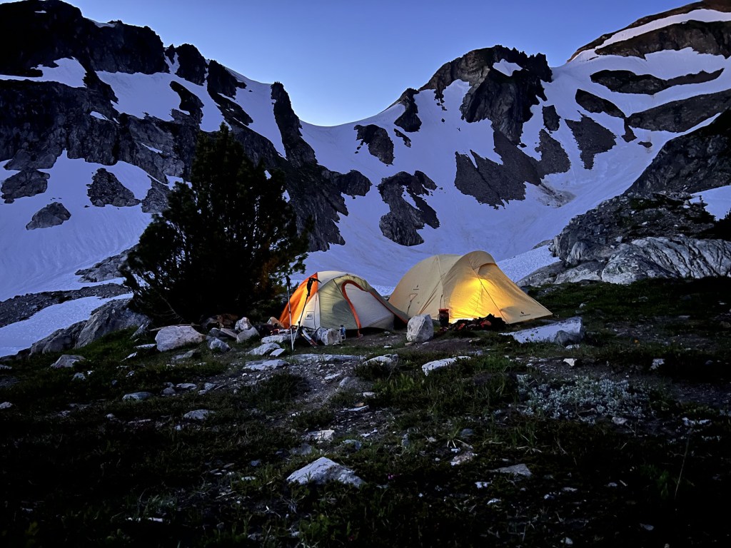
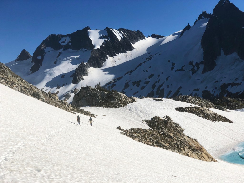
The snowfield above Ying Yang Lakes.All photos are copyrighted Richard Stum, 2022. Please DO NOT duplicate w/o permission.The snowfield right outside Ying Yang Lakes was low angle, so we were not roped up…so I was able to jump ahead and get this shot (do NOT duplicate).The scrambling on out of the Flat Creek drainage required a belay for most of the members of our party. It ate up a ton of time.Our actual route. At mile 25 was the difficult exposed class 4+ section. This is the route I wish we had taken, up an obvious snow couloir (possibly danger steep scree some years?). At a distance, it looked too steep, but was just the usual foreshortening. The traverse along the ridge above Flat Creek, looking down into the couloir I wished we had taken.White Rock Lakes. The descent was moderate angle so we just self-belayed most of it w/o roping up; in fact some glissaded down.White Rock Lakes campsite. The only camp where we were close to another party of climbers. Time exposure of our two tents, taken by some other climbers which we shared the location with.Accumulated stats up to that point.
Day 4
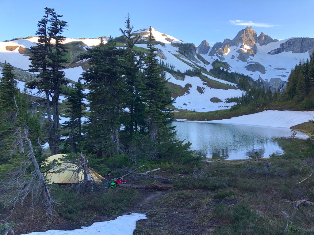
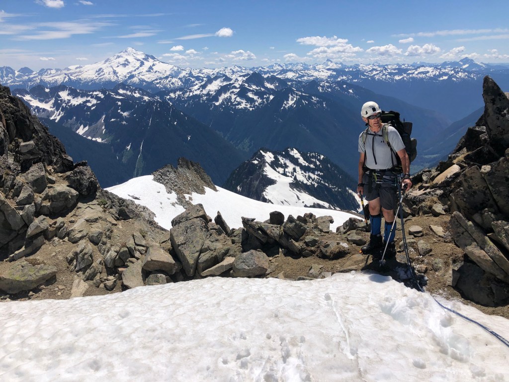
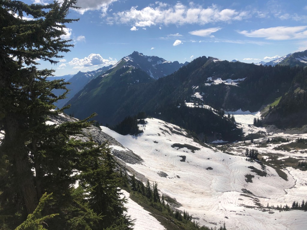
From White Rock Lakes, checking out the route for the next day. As it turned out, much of the “summer” trail was snow covered and we got off route doing some extra bushwhacking. We didn’t drop down far enough before beginning the final climb to gain the Dana Glacier.My crampons didn’t have any anti-balling plates so mid-way through, Karl cobbled together some using an old plastic bottle. Life saver for the last day or two. The right col of Spire Point doesn’t go. Proceed down the left-most col & then it is easy class 3 rock.Descending the dry side of Spire Point.Shortly after Spire Point. Steep snowfield (45+ degrees). In lean years this may be a deadly scree slope. I believe the normal route traverses off to the left in this photo and then down.Before Cub Lake, this is the last cirque that you drop through. The customary route has everyone going right through a water-covered cliff band. Dumb. Two of party took that, but two others took the route to the side through the heather and brush. MUCH safer and easier. Cirque w/o the route drawn.We camped in a meadow before Cub Lake as all it’s shores were snowpacked. Accumulated stats up to that point.
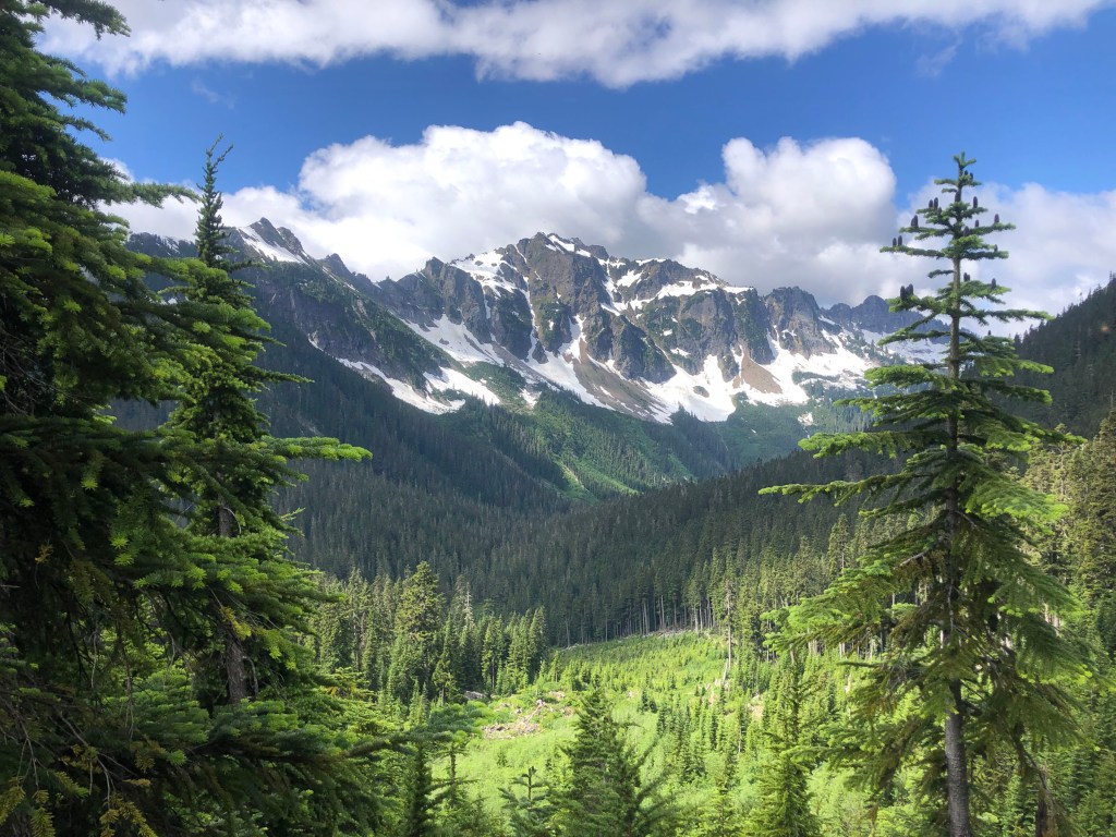
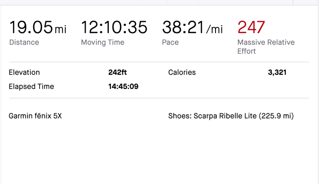
Day 5 — Final Day to the Car On paper the last day was supposed to be only 12 miles, but my GPS showed 19, due to all the meandering (& perhaps combined with errant satellite signals from traveling in a heavily forested area).
Cub LakeCircling around Cub Lake in the morning hours. Starting up & out of the basin of Cub Lake. Last climb of the trip…but I would have taken more climbing instead of bushwhacking later that day!This was an easy part of the trail…there were parts were there was downed timber, as large a diameter as a VW bug, requiring us to walk way around them. Bachelor Creek crossing. Not too hard, except the thick brush on both side of it and the trail that didn’t exist for miles on end. More bushwhacking. I captured the first four days as one trip on my GPS, but the last day was an orphan. The above stat is for the last day only.
I’m an old guy (age 69 in 2023) who enjoys aerobic, endurance sports. I call myself a cardio-junkie. Perhaps the more appropriate term would be “ultra” endurance sports. Since I was a teenager I have always enjoyed “slow twitch” outdoor sports like backpacking, ice climbing, running, mountaineering, hiking, alpine skiing and randonnée skiing (alpine touring, backcountry skiing or skimo). In 2005 I starting running with more regularity — except this time it was not for the intent of getting ready for a mountaineering trip, but as an end to itself. From 2005 to 2007 I managed to eek out two seasons of ultramarathons — that is competitive trail runs up to 50 or 100 miles. Due to a nagging ankle injury from the 80s (an accident while ice climbing in the 1980s where my lower tib and fib were badly broken), I had to cease that grueling, but rewarding activity. I then migrated into ultra distance road cycling or randonneuring. The rides are called brevets (pronounced bruh-VAY, it’s French) and are minimally supported — they are similar to ultrarunning and backpacking where one must be self reliant. Although brevets are non-competitive, they do have have cut off times to qualify as a finisher. They are usually are done in groups, which can have a competitive slant to them. Today, I continue to participate in long distance cycling including some ultra-racing, randonnée skiing (a blend of cross country and downhill disciplines) and still get out on an occasional mountaineering trip.
Since 1996 I have been designing, manufacturing and selling camera bags. That is Kinesis Photo Gear (kgear.com). In 2005 I started selling cycling bags under the Kinesis label and eventually expanded it to including other sports like SUP (stand-up paddle boarding and some skimo). Consequently, it become eoGEAR — the “eo” stands for endurance outdoor.
My wife and I are empty-nesters now and we live and work out in the boondocks of central Utah, half way between Salt Lake City (great powder) and Moab (great red rocks).
Well, I guess that is all for now. Safe travels mate! Perhaps I’ll see you on the road or trail.
— Richard Stum
View all posts by Rando Richard